

Feature
Why Enumclaw addresses are a founder or a five-digit number
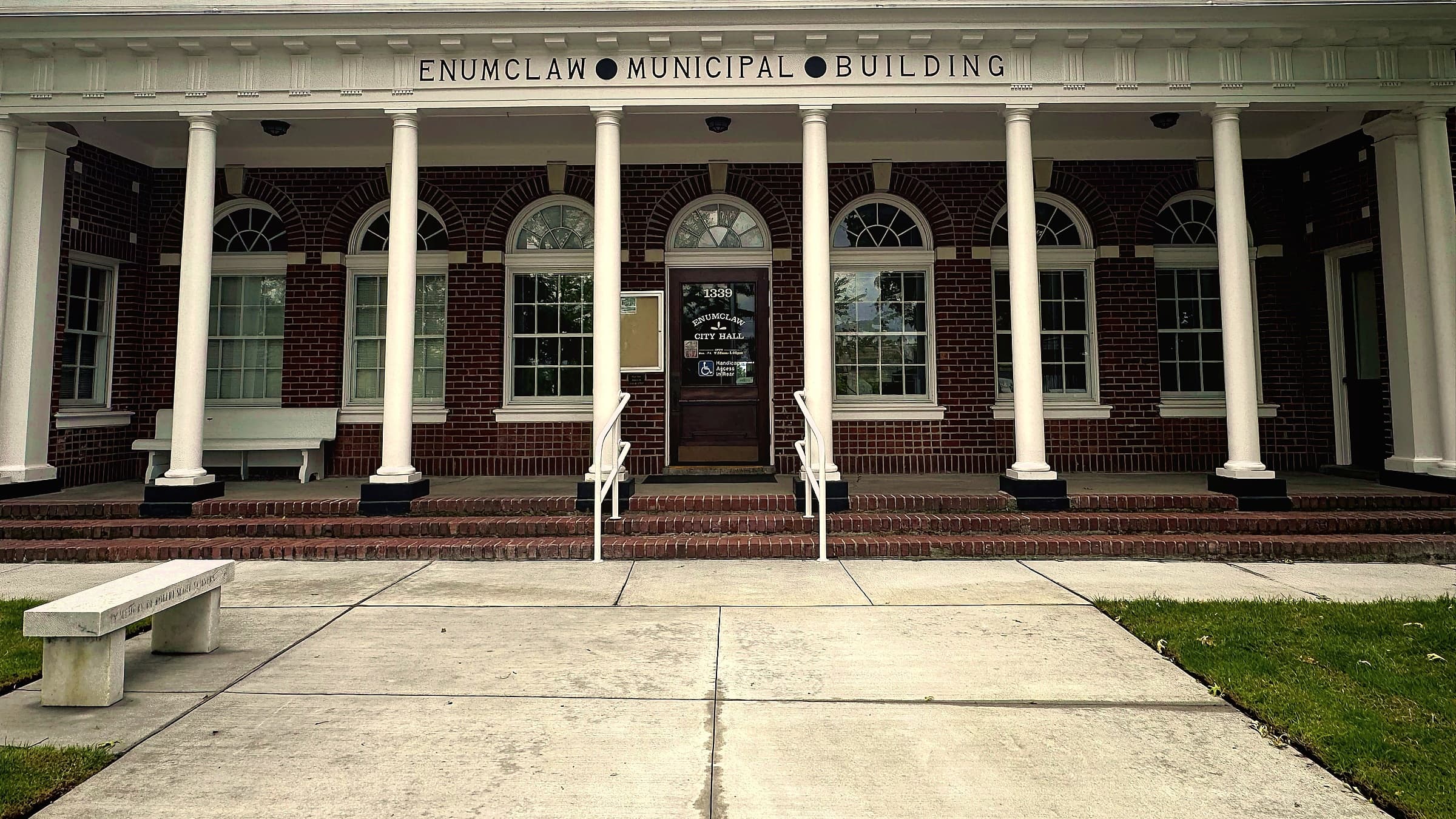
Inside the city limits the streets remember a postmaster, a well and a coal creek. Outside them, they count the distance from Pioneer Square. A field guide to both systems and the line where they collide.
Enumclaw City Hall is at 1339 Griffin Avenue. The Enumclaw Expo Center, which the city also runs, is at 45224 284th Avenue SE. They are two miles apart, share a ZIP code and a police department, and have addresses from different planets. One sounds like a house. The other sounds like a phone number read out too fast.
This is not a mistake. Inside the old town, a street is a way to remember somebody. Outside it, a street is a coordinate. Enumclaw has both because Enumclaw is two places: a mill town that named its streets after the people who built it, and a county that named everything else after arithmetic.
The county did the arithmetic
Every numbered road on the plateau is measuring its distance from a corner in downtown Seattle. The Seattle Times, in a 2005 explainer, located the county's "ground zero" for road numbers near First Avenue South and Main Street. That is the grid pioneer David Maynard drew on his claim south of Yesler Way, squared to true north while Denny and Boren angled theirs to the shoreline. Denny won downtown. Maynard got the county.
Slowly. King County Archives traces the spread to commissioners' resolutions in 1920, 1921 and 1930 that pushed the numbers past Seattle's limits, then to Resolution 16622 of August 13, 1956, which took the grid countywide and, in the archives' words, "authorized the use of numbers to replace names as often as possible." County code chapter 16.08 says named roads "can only be assigned when the numbered grid is determined infeasible by the department."
The rest of the rules explain the shape of every plateau address. Avenues run north and south and wear the directional as a suffix: 284th Avenue SE. Streets run east and west and wear it as a prefix: SE 416th Street. Ways, places, courts and drives may run either direction, which is the code's polite term for a road that gave up. Even numbers sit on the north side of a street and the east side of an avenue; odd take the south and west. Enumclaw is SE because the county's SE section is everything south and east of that Seattle corner, and it contains no part of Seattle at all.
The spacing is the part nobody tells you. South of Northeast 140th Street the grid advances 16 numbers to the mile, and a house number's leading digits tell you which line you are on. That is why the Expo Center's number has five digits. 45224 means the 452nd street line, 24 units along, and, being even, the east side of the avenue. The 284th is 284 sixteenths of a mile east of First Avenue South, nearly eighteen miles on paper. The address is not a name. It is a pair of coordinates wearing a mailbox.
How to read a plateau address without a map
Here is the trick. Roosevelt Avenue, the state highway through the south side of town, sits on the county's 448th line. Warner Avenue, eight blocks south, is on the 456th, and becomes SE 456th Way the moment it leaves the city at 244th Avenue SE. So SE 456th Street is Warner's line, half a mile south of Roosevelt. SE 416th Street is 32 lines the other way, two miles north of Roosevelt.
The avenues work the same way. Semanski Street is about the 252nd line and Farman Street North turns into 284th Avenue SE where it leaves town, so anything in the 260s and 270s is between them. A friend at 41000 on a 260s avenue is two and a half miles north of downtown, in dairy country, and you can say so before you have opened your phone.
The town did the remembering
Now the older, more sentimental half. Frank Stevenson, a Cornish coal miner, and Mary Fell Stevenson, from Ontario, homesteaded on the plateau in 1879. In 1885 the Northern Pacific accepted their offer of cleared, level ground for a siding, and on October 1 of that year the Stevensons recorded their townsite at the county auditor's office. They gave away lots for a saloon, run by Mary's father Joseph Fell, and for a general store run by John Blake and Arthur Griffin. One local history, on Patch, says Frank's first plat was radial, streets in concentric circles, until Blake talked him into a grid; the record on that is thin. What is not in doubt is that the first streets ran parallel to the railroad, not to true north, and the town has been slightly crooked ever since.
The names came from the people standing around. Initial Avenue was, in the words of the 1941 street history, "a beginning point for early avenues along the railroad grid," the first line the founders drew. Griffin Avenue is Arthur E. Griffin, the first postmaster. Wells Street is where the town dug its first drinking wells, three blocks up from the swampy flats by the tracks. Porter Street is Allen L. Porter, who claimed 320 acres near Osceola in 1853; he lived west of town, but his name went on the road to Black Diamond. Marion Street is Mrs. Marion Lee, wife of an electrician named Ivan P. Lee, and Myrtle Avenue is his sister, Myrtle Lee Holloway. Cole Street was originally spelled Coal, because it ran toward Coal Creek in Veazie and the town hoped the name would earn goodwill from the mining camps at Black Diamond, Franklin, Carbonado and Wilkeson.
We know this because the city engineer wrote it down. Basil M. McHugh held the job from 1920 to 1935 and wrote the street-names chapter of "The Pioneer History of Enumclaw," published by the Women's Progressive Club in 1941 and drawn on by the historian Bill Kombol for a 2023 Voice of the Valley column. The chapter also lists ten streets named for presidents and notes that Harding was originally French Street, for the French families of Fir Grove, and that the old name "can still be seen stamped in the sidewalk cement." Somebody should go and look.
Where the two systems meet
The founders' grid and the county's disagree about which way is north. Measured from OpenStreetMap road data, Cole Street runs about 25 degrees east of true north and Griffin crosses it at the same tilt, while Division Street runs dead north and Kibler Avenue dead east. McHugh explained why: Division marked the line between Section 23 and the Stevensons' Section 24, and Kibler "marks the starting line for the Township grid to the north as Division Street does to the west." The town already had a seam inside it, and the county grid follows the same section lines, which is why the two systems meet at the city limit instead of colliding at an angle.
Cleanly, but not quietly. Griffin Avenue, the postmaster's street, leaves the city on the west and becomes SE 436th Way inside one intersection. Porter Street, the road to Black Diamond, becomes 264th Avenue SE, which is still the road to Black Diamond, now under state highway number 169. McHugh Avenue heads east and turns into SE 432nd Street. And the town has its own 1st Street, a block east of the tracks, which McHugh says was counted from the Northern Pacific line. The county counts from Seattle. A driver told to find "First" has two starting points about thirty miles apart, and one is in Pioneer Square.
It is some comfort that this is not unique. State law lets cities name streets as they like, and the Seattle Times found the same collisions all over the Eastside. A pizza deliveryman told the paper, "The street planners had to be on drugs."
That is the choice, and Enumclaw made it twice. In 1913 the town incorporated and kept its founders' names. In 1956 the county voted to replace names with numbers wherever it could, and the plateau outside the line got a coordinate system. So when a friend says they live at 45000 on a 270s avenue, you know two things: where they are, to the sixteenth of a mile, and that nobody was ever going to name that road after them. Inside the line, a street can still be somebody. Outside it, a street is how far you are from Seattle, which, come to think of it, is how most people up here describe themselves too.
Story label: Original Story or Guide
Originally published: