

Feature
Every road out of Enumclaw has a number
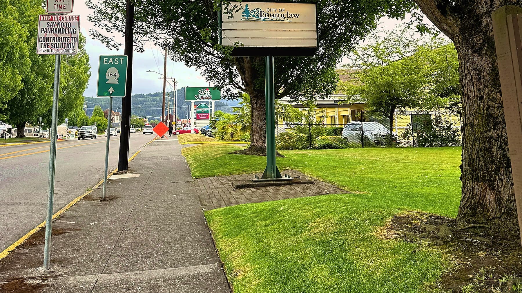
Four state highways leave town in four directions. One was paid for with ox hides, one was built for coal, one leads to a tent that became the biggest casino in Washington, and the state describes the whole town in a single comma.
Open the Revised Code of Washington to chapter 47.17 and you will find Enumclaw described the way the state actually thinks of it, which is as a place other roads pass through. State Route 164, says RCW 47.17.320, begins near Auburn and runs "southeasterly to a junction with state route number 410 at Enumclaw." State Route 169 begins "at a junction with state route number 164 at Enumclaw" and heads for Renton "by way of Summit," a place I defy you to find on a map. State Route 410 goes from Sumner to Yakima "by way of Buckley, Enumclaw, and Chinook Pass." That is the town's entire legal existence in the highway code: a junction, a junction, and a comma.
Which is fair. Enumclaw has 12,543 people by the 2020 census and four numbered highways, and you cannot leave in any direction without the state assigning you a number. Every one was built for a reason that has almost nothing to do with the town. Here they are, in order of how much livestock died.
SR 410 east: the road that cost three oxen
The green shield on Roosevelt Avenue says 410. The brown one says Chinook Scenic Byway, 92 miles from Enumclaw to Naches, an All-American Road since 1998. Neither mentions that the whole idea started with a wagon train lowered off a cliff.
In the fall of 1853, more than 30 wagons under James Longmire and James Biles left the Oregon Trail at Umatilla and struck north for Puget Sound, the first emigrant wagons to attempt the Cascades. HistoryLink's Kit Oldham has the particulars: they followed the Naches River for four days and crossed it 52 times by Longmire's count, rested at Summit Prairie (now Government Meadow), and then reached the top of Naches Pass and a drop of several hundred yards that Oldham describes as "precipitate, nearly vertical." The crew that was supposed to have cut a road down the west side had run out of supplies and gone home.
So they roped the wagons down one at a time, one end tied to the axle, the other looped around a tree and paid out by several men. The rope ran short. According to First Three Wagon Trains, the book Longmire co-wrote, as quoted by the South Hill Historical Society, they slaughtered three oxen and cut the hides into strips to lengthen it. The descent took two days and wrecked two wagons; the Lane family finished on horseback. Everyone else reached Fort Steilacoom on October 9, 1853.
The modern highway does not use Naches Pass at all. When the state finally built across the mountains it went over Chinook Pass instead, 5,430 feet, because Naches would have needed a tunnel and nobody wanted to pay for one. The state named the project the Naches Pass Highway in 1921, then spent the rest of the decade not finishing it. Enumclaw celebrated anyway. On September 13, 1931, residents of Enumclaw and Yakima met at the summit and staged a mock wedding between a bride named Yakima Peaches and a groom named Enumclaw Cream. The two halves of the road met at Tipsoo Lake in 1931, and on July 2, 1932, the route was dedicated as the Mather Memorial Parkway, for Stephen Mather of the National Park Service. Congress had already set aside 50 miles of timber along it; the trees past Greenwater are, technically, an act of Congress.
Most years the state shuts 410 from Crystal Mountain Boulevard to Morse Creek, roughly 17 miles, in November, and most years it opens again in May. Crystal Mountain opened on December 8, 1962, with two double chairs and seven rope tows, which is why January traffic on Roosevelt wears goggles.
SR 410 west: the road with the bridge everybody hit
Go the other way on Roosevelt and 410 crosses the White River into Buckley on a steel truss bridge built in 1949. About 22,000 vehicles use it a day, nearly twice the population of the town. On August 18, 2025, an over-height vehicle hit the overhead beams hard enough to close it for two months. The official detour ran 410 to 167 to 18 to 164, through Sumner and Auburn, a two-county tour for a five-minute errand. It reopened October 17, two weeks early, with new clearance signs and a five to six million dollar repair bill.
For 41 years this was a U.S. highway: US 410, created November 11, 1926, Aberdeen to Lewiston, Idaho, by way of Enumclaw. It was demoted on June 20, 1967, when US 12 absorbed most of the route.
SR 164: the road to the tent
Griffin Avenue is SR 164, 14.82 miles from the Roosevelt corner to Highway 18 in Auburn. HistoryLink records that the town's Good Roads Association lobbied the state to pave "the narrow winding road to Auburn," because Auburn had the Interurban and the Interurban had Seattle. It has carried the 164 number only since 1969.
It runs through the Muckleshoot Reservation, recommended by Governor Isaac Stevens on December 5, 1856, and fixed by an 1874 executive order at 3,533 acres. The tribe opened its casino on April 26, 1995, inside a 13,000 square foot tent. The tent is now a 157,000 square foot gaming floor with an 18-story hotel tower, billed as the largest casino resort in the state, and the reason the Auburn end of 164 has its own genre of complaint. The Auburn Reporter in 2019 quoted one resident in full: "It's nuts." The Legislature ordered bypass options in 2008 and put $15 million toward the corridor in 2015; WSDOT's project page now lists the eventual cost at possibly more than $100 million and the status as on hold. The fish did better: a 2021 culvert replacement at Pussyfoot Creek opened 9.3 miles of stream to salmon in three months.
SR 169: the road coal built
Porter Street becomes SR 169 at the Griffin corner and runs 25.26 miles to Renton through Black Diamond and Maple Valley. It exists because of a railroad. The Columbia & Puget Sound line reached Black Diamond on December 12, 1884, built mostly by Chinese laborers camped at Jones Lake, and for the better part of a century it hauled coal down the Cedar River valley to Seattle. The last train ran on September 22, 1970. Much of the grade is now the Cedar River Trail.
The highway followed in 1914, when King County replaced grades of up to 20 percent with a road that topped out at 5, and spent $30,000 on a steel bridge across the Green River gorge. Rebuilt in 1932 and 1933, it is now the Dan Evans Bridge, 688 feet long and 155 feet above the water. In August 2025 inspectors found cracking and corrosion in its stringers, rated it "poor," and put its 11,364 daily vehicles on one-lane signals, with a nine mile detour promised for the full closure. The Enumclaw end of the road handles about 7,700 cars a day; the Renton end, 43,000. That gradient tells you which way the plateau commutes.
The county roads that dress up as highways
Then there are the roads with names instead of numbers, which in King County means they are older. Green Valley Road runs 11 miles from Highway 18 to SR 169, and its middle section began as the W.D. Lytz Road No. 128, petitioned in 1884. Until about 1970 a sign at the west end listed every family in the valley and how far up the road they lived. In 2010 the county named it a heritage corridor, a designation it was careful to say changes nothing.
What it means to be a comma
Add it up. Twenty-two thousand vehicles a day on the bridge to Buckley. Eleven thousand over the gorge toward Renton. Goggles heading up 410, buses heading down 164. Nearly all of it is going somewhere else: a mountain, a pass, a casino, a city. A town of twelve and a half thousand sits where four roads cross and watches most of the county go by.
Enumclaw has never seemed to mind. It threw a wedding for a highway that was not finished. Its own comprehensive plan calls it a gateway, the polite word for a place you go through. Even the men who lowered their wagons off Naches Pass on ox hide did not stop here. They kept going to Steilacoom.
But roads have to meet somewhere, and everyone who uses these, sooner or later, slows down at Griffin and Roosevelt, where 164 ends, 410 turns, and 169 starts a few blocks up on Porter. Look around when you do. It is the only place in the highway code where all the numbers agree.
Story label: Original Story or Guide
Originally published: