

Feature
The White River is white because the largest glacier in the lower 48 is grinding Mount Rainier into flour
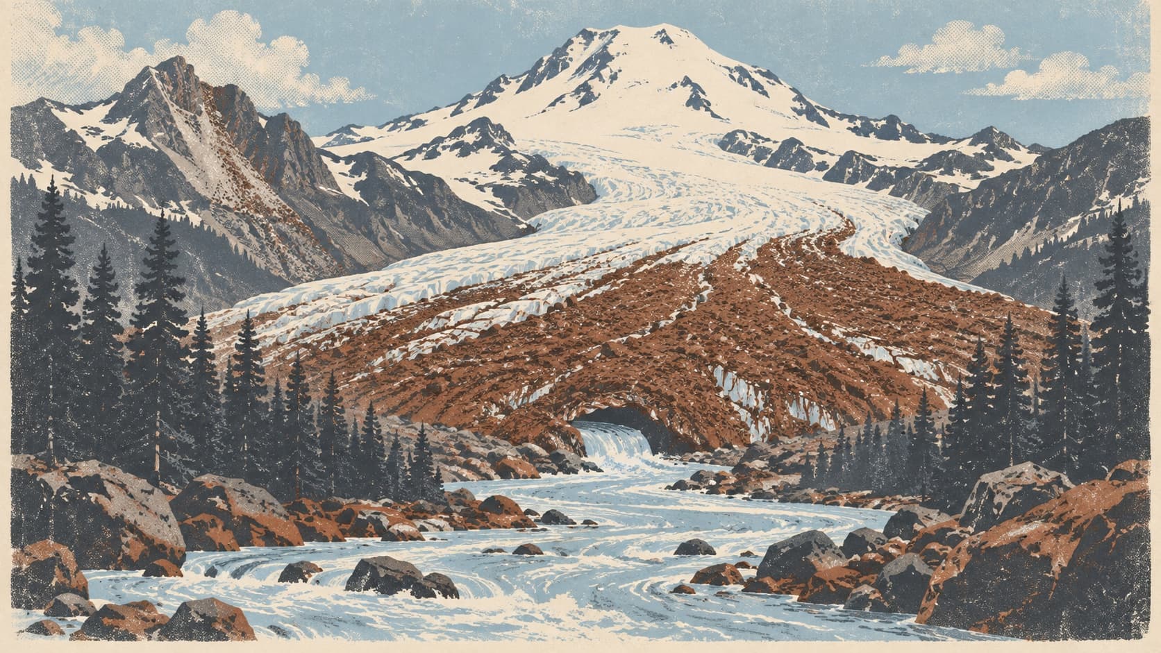
The White River begins under the largest glacier in the lower 48 and moves 550,000 tonnes of sand and silt a year. Why it is milky, and why Pacific floods.
Theodore Winthrop forded the White River in August 1853, called it by the name the people who lived on it used, and then described it: "Rapid, turbulent, and deep was the S'Kamish, white with powder of the boulders it had been churning above, and so turbid that boulders here were invisible." He had the mechanism right in one sentence. This piece is the rest.
In September the river at the Buckley bridge is at its lowest of the year and, to the eye, its whitest, the color of milk somebody has stirred a spoon of ash into, and you cannot see the bottom. Every other stream on the plateau shows you its bed. Boise Creek runs clear. The springs the town drinks from run clear. The Green, one valley north, is a different color entirely. The White River is the one that hides what it is doing, and what it is doing is carrying the mountain.
Four and a quarter square miles
The river begins under the largest glacier by area in the contiguous United States. The Park Service's 2021 inventory measured the Emmons Glacier, on Rainier's northeast face, at 4.231 square miles, give or take about a fifth of a square mile, first by area of the 29 glaciers in that inventory, 4.55 miles long, from 14,148 feet near the summit to a terminus at 4,883 feet. The Carbon Glacier, on the north side, holds more ice; the Emmons spreads over more ground. The Winthrop Glacier next to it, second on the list at 3.35 square miles, feeds the West Fork of the White at the 4,700-foot level, and the two forks meet some twenty miles downstream, outside the park. In the ice age the Emmons ran nearly forty miles and stood nearly a thousand feet thick where the White River Campground is now.
The Park Service makes a point at its Emmons overlook that matters for what follows: the glacier does not end where the white ice ends. It ends lower, where the river can be seen coming out from under a front of dark, rock-covered ice. That rock is likely the reason the Emmons has done something few glaciers in the Northern Hemisphere have managed in recent decades.
Flour
What comes out from under the ice is water carrying rock ground finer than sand. Glacier flour, in the Park Service's term, is rock ground so fine that moving water keeps it in suspension, which is what turns glacier-fed rivers and lakes the color of milk. The Army Corps of Engineers, in the operating manual for Mud Mountain Dam, puts it in its own words: in summer much of the river's flow is glacial melt, which introduces very fine-grained suspended sediment, commonly referred to as glacial flour, and gives the water its milky appearance. The same manual notes that the White carries a heavier load of silt, sand, gravel and small boulders up to about two feet across than is normal for a western Washington river, because of where it comes from.
Gravel rolls along the bottom in floods. Sand settles where the river slows. Flour does neither; it rides in the water until the water slows enough to drop it, which for most of it means the Puyallup and Commencement Bay.
Late afternoon
The best measurements of the river at its source were made by a USGS geologist named Robert Fahnestock, who worked out of a camp near the Emmons terminus in the summers of 1957 to 1959 and gauged what came out. The glacier, he found, keeps hours. On July 22, 1958 the flow at his gauge a mile below the ice rose from 140 cubic feet per second in the early morning to about 600 in the late afternoon, and the daily swing, he wrote, "reaches its peak in the late afternoon and its low point in the early morning." In winter the swing was an estimated ten cubic feet per second. After cloudy cool weather the stream turned milky; in flood it looked, in his words, like fluid mud. No published measurement gives the time that afternoon pulse takes to reach Enumclaw, so this piece will not give you a clock time for the plateau. It will give you the calendar.
At the USGS gauge just below Mud Mountain Dam the river averaged 1,436 cubic feet per second over 68 years of record to 2001, with a maximum of 17,000 on February 26, 1932 and a 1933 flood estimated from high-water marks at 28,000. At its successor gauge at Buckley the highest month is May, on snowmelt, at about 2,200 cubic feet per second, and the lowest is September, at under 600. By late summer the ice is barest of snow, so what flow there is carries a heavy share of flour. That is the likeliest reason the river at the Buckley bridge looks whitest in the month it is smallest.
December 14, 1963
On that day, and probably several times after, very large masses of rock fell from Little Tahoma Peak onto the Emmons Glacier. The USGS, which sent two geologists the next summer, counted at least seven separate avalanches with a total volume of about 14 million cubic yards, dropping as much as 6,200 feet and rushing as much as 4.3 miles down the glacier and the valley at 80 or 90 miles an hour or more, to stop less than half a mile from the White River Campground. The rock traveled that far, the geologists concluded, on a cushion of trapped and compressed air, and the first fall may have been set off by a small steam explosion at the base of the peak. Nobody saw it happen; the debris was noticed from the Sunrise visitor center when the snow melted the next summer. It was December.
What the rock did next played out over twenty years. The USGS's 1993 summary of the mountain's glaciers says it in three sentences: "In 1963, a rockfall from Little Tahoma Peak covered the lower glacier with rock debris. The debris cover insulates the ice from melting. As a result of decreased melting, the glacier advanced rapidly in the early 1980's." Iowa State University researchers who measured the debris, in reports the park published in 2017, found it covering the lower third of the glacier, and wrote that the terminus had advanced since the 1970s and that the Emmons "is currently one of few glaciers in the Northern Hemisphere that has not been shrinking in the past few decades." A blanket of rock more than a few inches thick, they explained, slows melting overall. Across the two glaciers the park has monitored since 2003, the Emmons and the Nisqually, about 27 percent of the surface is debris, and the debris cuts melt by about 30 percent.
It did not stop the loss. From 2003 to 2016 the Emmons lost the equivalent of roughly 13 meters of water across its surface, with a wide margin of error, by the park's accounting, and the monitoring continues. A retired park geomorphologist, Paul Kennard, told the Courier-Herald in 2021: "We've lost eight glaciers at Mount Rainier in my lifetime." The Emmons is not one of them, and a landslide is part of the reason.
The Corps' manual, quoting a 1983 state volcanic-hazards assessment, adds a footnote that belongs to a different story: it was the rapid deterioration of the Emmons in 1969, that report says, that first raised serious concern about volcanic activity in the Cascades. This site's volcano pieces take that up.
550,000 tonnes
Now go downstream. A 2019 study by King County and the USGS put the river's suspended load, the flour and the sand riding with it, at about 550,000 tonnes a year between 2011 and 2018, 60 percent sand and 40 percent silt and clay. Mud Mountain Dam, seven miles from Enumclaw, does not stop it. The dam holds almost no pool most of the year and empties within days or weeks after a flood through tunnels set near the old riverbed, so most of the silt and sand keeps going. The bed load, the sand and gravel that roll, is about 35,000 tonnes a year, and the river's fan below Auburn, the study found, traps essentially all of it.
That is the arithmetic behind the flooding in Pacific. Since the late 1980s, the study says, the lower river has aggraded about two meters, roughly two inches a year, and about three meters since 1945. Dredging stopped in the 1980s. An earlier USGS study measured the bed near Auburn rising 1.8 inches a year between 1984 and 2009 and the channel between the R Street bridge and the Lake Tapps return losing 20 to 50 percent of its capacity. The Corps' 2004 manual says the channel can no longer carry the dam's designed release of 17,600 cubic feet per second and limits releases to 12,000; the 2019 study says that from 2009 the limit fell again, to 200 cubic meters per second, about 7,060 cubic feet. The levees below Auburn were built for 25,000.
The less obvious finding was where the gravel comes from. The gravel filling Pacific's channel is not, for the most part, from the glacier. The study traced it to the canyon below the dam, where a steep stretch has been eroding upstream since the river changed course in 1906, delivering 40,000 to 50,000 cubic meters a year of old valley fill; the valley floors below the two glaciers, mostly along the West Fork, sent down about 30,000 cubic meters a year between 2008 and 2017, and the glacier forelands themselves almost nothing outside rare storm pulses. The flour is the mountain's. The gravel is the river digging up its own history.
Pacific
The December 2025 storms were among the strongest and longest-lasting in King County since 1959, by the county's account. Mud Mountain Dam peaked at 1,185 feet, 70 percent full, on the night of December 12, as this site's dam piece records. Three nights later, before 1:30 in the morning on December 16, a section of temporary barrier in Pacific failed in under thirty seconds and the river came through a hole four feet deep and twenty wide; 220 homes were affected. In February the county flood district approved about $2.62 million for six emergency projects on the White, and the county planned to start replacing the temporary barriers along 3rd Avenue SE in late August. The county's own page says what its models show: flood risk on the lower White will keep rising because of ongoing sediment deposition. The one large fix so far is the Countyline levee setback finished in December 2017, which removed 4,500 feet of old levee, built 6,000 feet of new levee farther back, and gave the river 121 acres to spread out in.
Set that beside the number at the top of this section: half a million tonnes a year, from a river that has been building ground with it since the ice age. The plateau the mountain built with the Osceola Mudflow, 5,600 years ago, is the subject of another piece here. Pacific is the current project.
Names
The Wilkes Expedition wrote down an Indian name for the river in 1841, Smalocho. Winthrop, in 1853, called it the S'Kamish and, on the east side of the pass, noted in his journal that the water there was clear, unlike the White River's, which was muddy white. Preston's 1856 map charted it as Stkamish, from the Sekamish people who lived along it, whose descendants are among the Muckleshoot today. Edmond Meany, cataloguing the state's place names in 1923, settled the question of the English name in one line: it came from the glacial milk in the stream. On November 14, 1906 a flood and a log jam sent the whole river south into the Stuck channel toward the Puyallup, where it still goes; Major Hiram Chittenden of the Corps, asked afterward whether to put it back, said nature had transferred the course and it would be simpler to perpetuate it than to change it again.
So the river that runs along the south edge of the plateau has had three names and one color, and the color is the oldest thing about it. Every other stream on the plateau shows you its bed. This one shows you the mountain, ground fine, on its way to the Sound.
Story label: Original Story or Guide
Originally published: