

Feature
The Green River Gorge: the canyon the coal towns looked down into
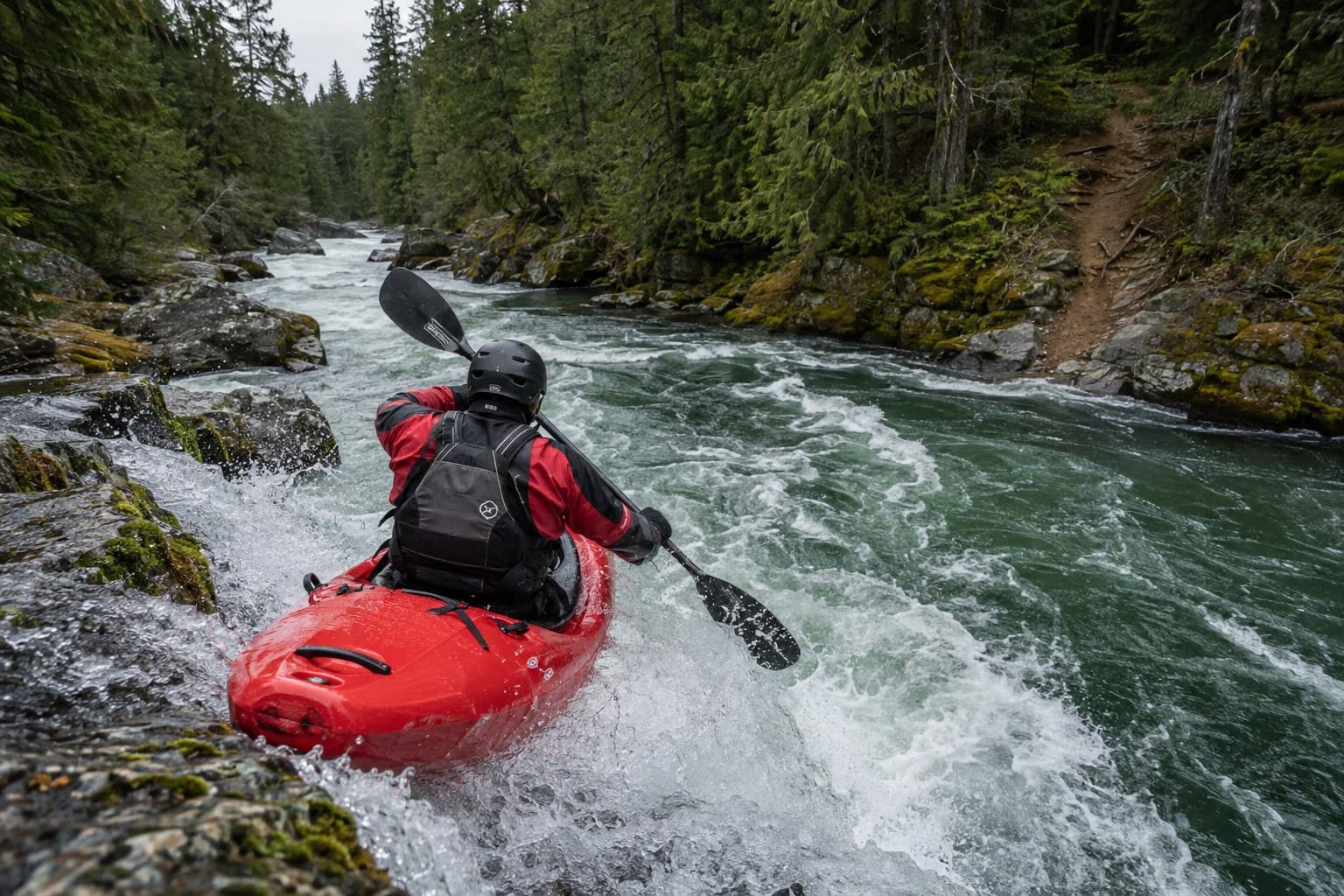
A river sawed 300 feet into Eocene sandstone a few miles north of Enumclaw. Then came the mines, a one-lane bridge, a resort, a state law, and a swimming hole that keeps killing people.
Stand on the Green River Gorge Bridge and look down. That is the whole instruction. The bridge is one lane wide and dates from 1915, with a signal at each end by local account, and King County would rather you wait than meet a pickup halfway across. Below the deck the Green River is doing what it did long before anyone was around to name it: cutting through sandstone a few grains at a time, on its way to Auburn and the sea.
The rock is the Puget Group, sandstone, siltstone and coal laid down in the Eocene, when this corner of Washington was a warm, swampy river delta. James D. Vine, a USGS geologist writing for the state Division of Mines and Geology in 1962, put the Puget Group in the Green River area at about 6,000 feet thick, "arkosic micaceous sandstone, siltstone, and coal beds." The 1969 law that protects the gorge says it in plainer English: almost two miles of Eocene rock and fossils, "one of the most complete stratographic sections to be found in the region," in walls "from one hundred fifty to three hundred feet" high.
The coal is the point. Those black bands are compressed swamp, and they are why three towns went up along the rim in the 1880s and why two of them are gone.
Twelve miles and one law
In the 1950s Wolf Bauer and three friends from the Washington Foldboat Club became the first people to kayak the gorge, according to a 2003 King County Journal history republished by the Black Diamond Historical Society. In 1966 Bauer wrote a newspaper piece called "A Ribbon of Wilderness in Our Midst." On April 24, 1969, Governor Dan Evans signed the bill creating the Green River Gorge Conservation Area. The statute, now RCW 79A.05.700, calls for buying "a twelve-mile strip incorporating the visual basins of the Green River from the Kummer bridge to Palmer." Purchases began that October, and by the commission's count it held 2,285 acres there as of 2023.
Flaming Geyser State Park sits at the downstream mouth, its overpromising name a story of its own. Kanaskat-Palmer holds the top.
Kanaskat-Palmer State Park and the whitewater
Kanaskat-Palmer is 320 acres of forest on a low plateau with about two miles of Green River shoreline, at 32101 Cumberland-Kanaskat Road. It opens at 8 a.m., closes at dusk, and wants a Discover Pass. The state began buying the land in 1973 and dedicated the park in September 1983. It has campsites, yurts, and a fire station next door whose siren, State Parks warns, "may be activated at any hour."
The river here is rated Class II to IV, and the park page says "rafting and kayaking on the Green River is for experts only." American Whitewater splits it into two runs. The upper one starts at Tacoma Water's Headworks and drops four miles to the park at Class II+, with one Class III ledge called Railroad Bridge Drop; boaters reach it through Tacoma's security gate under a negotiated access agreement. The lower run, the gorge proper, goes 12.1 miles from Kanaskat-Palmer to Flaming Geyser at Class III to IV. The rapids have names: Ledge Drop One and Two, Pipeline, Mercury, Nozzle, Let's Make a Deal, Paradise Ledge. The season is October to May, and boaters read the USGS gauge near Palmer before they commit.
The bridge and the resort
The Green River Gorge Bridge is a Baltimore Petit deck truss, the only one King County owns, built in 1915 to join Green River Gorge Road on the west bank to the Enumclaw-Franklin Road on the east. It became a county landmark in 2004. The King County Journal put the deck 150 feet above the water. Nobody who has stood on it disputes the number.
The resort grew up beside it. John and Mary Rudge, a Welsh coal miner and his wife from Cumberland, bought 13 acres at the bridge for $1,860 in 1921 and 1922 and by about 1925 had a hotel, cabins and a gas station called Jack's Place. Jim and Linda Carter bought the property in 1977 and, by the Journal's account, closed the resort in the mid-1980s over insurance liability. What remains is private land, a $5 honor box, a steep trail, and the only river access between the two state parks. That access is the problem.
The towns on the rim
Franklin came first, on the east bank, after the McKay seam was found in July 1880. On August 24, 1894, a fire in the Oregon Improvement Company mine there killed 37 men. Franklin's whole arc, the fire, the cemetery, the sealed shaft, is told in There used to be a town here, and we will not retell it.
Cumberland, up the road on the Enumclaw side, was a mining camp that F. X. Schriner named in 1893 after the Cumberland coal region of Appalachia, according to the Black Diamond Historical Society. It never emptied out, and the City Hall Saloon still pours.
Black Diamond was the company town. The Black Diamond Coal Company came up from Nortonville, California, ran a rail line southeast from Renton, and had its mines open by 1884. By 1900 nearly 3,500 people lived there. The Pacific Coast Company bought it in 1904 and shut the mines by 1958; the town incorporated in 1959, and the depot is now the museum.
And Kummer, the clay town at the SR 169 crossing, survives as the name locals still give the state's 1932 Dan Evans Bridge.
The water is cold
On Saturday, July 18, 2026, a 20-year-old named Daniel Petersen-Lloyd went under while swimming below the Green River Gorge Bridge. The King County Medical Examiner ruled it an accidental drowning. On May 16, 2020, a 27-year-old woman hiking the river with two roommates slipped and fell in and drowned; one roommate went in after her and got out, the King County Sheriff's Office said. On May 14, 2021, a 21-year-old man fell into the river near the bridge and, according to the Sheriff's Office, died while trying to help another person to shore.
Public Health - Seattle & King County says the county's rivers and lakes stay between 50 and 60 degrees in summer, cold enough to trigger cold water shock, and that "even strong swimmers can experience muscle failure" within seconds. John Taylor, the county's parks director, said it in May 2025: "Rivers that appear calm can have strong currents and hidden obstacles." The Sheriff's Office asks that anyone jumping check depth and hazards first. Wear a life jacket. Stay out of the current.
Fish and the Headworks
Tacoma has drunk from this river since July 12, 1913, when the first 42 million gallons a day arrived through 43 miles of wood and steel pipe. Tacoma Water's diversion dam sits about three miles upstream of Kanaskat-Palmer, and the 148,000-acre municipal watershed above it is gated and guarded. Anglers work the park and the Franklin stretch for winter steelhead and trout, but the Green above the Auburn-Black Diamond Road bridge closes September 16 to October 31. Read the Fish and Wildlife pamphlet first.
Getting there from Enumclaw
SR 169 leaves downtown Enumclaw at Porter Street and runs north. About two miles short of Black Diamond it crosses the gorge on the Dan Evans Bridge, 155 feet up. In Black Diamond, turn right on Lawson Street; it becomes Franklin Howard Road and then SE Green River Gorge Road, and ends at the 1915 bridge, the Franklin parking field and the resort trail.
For Kanaskat-Palmer, take Veazie-Cumberland Road northeast to Cumberland, about nine miles by the Historical Society's reckoning, then Cumberland-Kanaskat Road to the park. From the north, leave SR 169 on SE Kent-Kangley Road, bear right onto Retreat-Kanaskat Road SE, then right on Cumberland-Kanaskat Road SE.
Either way you end up on the rim, looking down at a river that got here first and is still working.
Story label: Original Story or Guide
Originally published: