

Feature
Yakima Canyon scenic drive on Highway 821, stop by stop
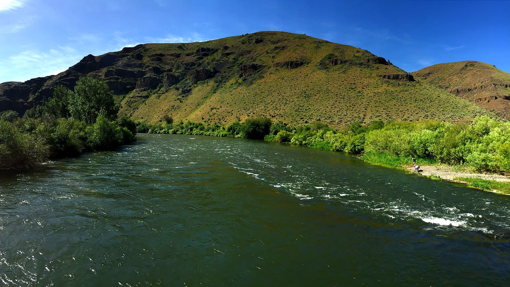
Yakima Canyon scenic drive on Highway 821: four BLM river stops, fees, bighorn sheep, winter notes and the 1924 road, about 115 miles from Enumclaw.
The Yakima Canyon scenic drive is State Route 821, about 25 miles of two-lane road beside the Yakima River between Selah and Ellensburg, and from Enumclaw its north end is roughly 115 miles and two and a half hours away by Interstate 90, on a public routing engine's figures. As of October 2026 the Bureau of Land Management lists four river recreation sites along the road, at mileposts 7, 10, 12 and 16, open year-round at $5 for day use and $15 overnight, with no drinking water at any of them.
The hook is the sheep. By the Washington Department of Fish and Wildlife's account, bighorn sheep were gone from the state by the mid-1920s, and the canyon road opened on September 12, 1924. The state Department of Transportation's 2014 corridor plan says the canyon is "home to more than half the state's 1,500 wild bighorn sheep," and counts nearly 800 animals in its herds in 2010.
How far is the Yakima Canyon drive from Enumclaw?
About 115 miles to the north end of the highway, which is an Interstate 82 interchange at Ellensburg, and about 25 miles more to drive its length to Selah. The routing engine sends you north on SR 169, east on SR 18 and Interstate 90, then south on Canyon Road. By WSDOT's count 22 of the highway's 25 miles lie inside the canyon itself, while the BLM's page says 27 miles between Ellensburg and Yakima, and WSDOT's real-time page for SR 821 reports mountain passes separately and lists none on this road.
Getting from Enumclaw to the dry side is the part with passes. State Route 410 over Chinook Pass closes for the season each autumn, and the Chinook Pass closing-dates guide keeps the record. The Enumclaw to Yakima winter guide covers the Snoqualmie and White Pass routes and their chain rules, so this page starts where the canyon does. The stops below run south from Ellensburg, the order in which a driver from Enumclaw meets them.
1. Umtanum Recreation Site, milepost 16
Umtanum is the first river stop heading south, and the one with a bridge. The BLM's page lists a paved day-use lot of 60 spaces, six campsites on a gravel loop, twelve more walk-in sites along a rocky road at the south end, and a vault toilet, which is a pit toilet without plumbing. A historic bridge crosses the river from the campground to trails on the other side, with a scenic overlook beside it.
WSDOT's plan calls the wooden footbridge the only foot access to the canyon's west side, which it describes as WDFW-managed land and trails in the Wenas. That matters for the pass. The WDFW page for the Wenas Wildlife Area says a Discover Pass is required on its lands unless you hold a Vehicle Access Pass issued with an eligible hunting or fishing license, and the which-pass guide explains how that pass differs from the others. The same WDFW page lists a campfire ban from April 15 through October 15, and WSDOT's plan adds that rattlesnakes are common in the Umtanum area after the snow melts in spring.
2. Lmuma Creek Recreation Site, milepost 12
Lmuma Creek is the small one. The BLM lists a gravel lot of about 20 spaces, seven campsites, the first four seasonally shaded by trees, two single vault toilets, and a path that climbs from the campground to an overlook with a bench. It is the quickest stop to read in an afternoon, a place to get out of the car for the river and the cliffs rather than for any amenity.
The BLM's one specific wildlife claim is about birds. Its Yakima River Canyon page says the canyon's crevices and cliffs are a home for "the densest concentration of nesting hawks, eagles, and falcons in the state." That is the BLM's statement, not a count this page can check.
3. Big Pines Recreation Site, milepost 10
Big Pines is the largest of the four, with 42 campsites, five paved parking areas, four double vault toilets and a boat launch with an accessible loading platform, by the BLM's listing. The page rates cell coverage here as moderate, a step above the spotty coverage it lists at the other three. WSDOT's plan puts the site at 20 acres, bars motorboats from its launch, and notes that its northern edge touches undeveloped hiking trails on WDFW land, which brings the Discover Pass question back for anyone who walks off the BLM ground.
4. Roza Recreation Site, milepost 7
Roza is the southernmost of the four, half a mile above Roza Dam, with 120 paved parking spaces, six shaded campsites and two picnic shelters. The BLM's older brochure PDF calls it the main take-out for river floaters, because the dam lies half a mile downstream.
It was once a town. WSDOT's plan describes a railroad construction camp on the fan of ground at the mouth of Roza Creek, then a settlement with a Northern Pacific depot, a post office, mills that crushed diatomaceous earth and a school that served the canyon from 1897 to 1926. When the highway builders arrived, the Herald says, their camp for 400 workers sat at the old silica mill site at Roza.
5. Bighorn Recreation Site, the newest stop
The BLM acquired Bighorn in spring 2024. Its page describes the site as under interim management with mainly temporary facilities: a loop of 15 campsites, day-use parking, and rented portable toilets. It gives no milepost, and its accessibility notes were uploaded in November 2024, so a visitor should expect the facilities to have changed since. The page also counts the sites two ways, four in its list of campground and day-use sites and five developed river access sites in its introduction, and Bighorn is the difference.
Can you see bighorn sheep from Highway 821?
Sometimes, and no agency promises it. WDFW says bighorns "can often be seen from highways and roadways in the canyon country of southeast Washington and the eastern slopes of the Cascades," which describes the state's range, not this road. WDFW's bighorn page adds that the rut generally runs from October to January and lambing from early April to June.
For the canyon, WSDOT's plan gives two herds split by the river: the Selah Butte herd, about 540 animals in 2010, east of it, and the Umtanum herd, about 260, to the west. It also records a pneumonia outbreak and WDFW's removal of diseased animals in winter 2010. No newer count was opened for this page. WDFW's Wenas page calls big game hunting popular on the wildlife area across the river, so in fall the hills carry hunters too; the hunting-season guide for hikers covers western Washington dates, and WDFW's seasons govern the east side.
Who built the Canyon Road, and when did it open?
The state did, in the 1920s, after a private toll road failed in the 1880s. By the Yakima Herald-Republic's history column, Jacob Durr cut a toll road west of the canyon in the 1880s and charged $25 a year, and the venture failed when travelers decided it was not worth the toll. The Northern Pacific ran its line through the canyon in 1885, and the canyon was then rejected as a highway route because it seemed to lack room for both.
Grant Smith and Company of Seattle won the grading contract, with work meant to begin in October 1922, on a bid of $556,739 for 20.5 miles, which the Herald calls one of the largest road contracts in the state at the time. The Yakima Morning Herald reported that completing the road would "eliminate the drive between Yakima and Ellensburg which has aroused so much ire on the part of motorists." The road opened on September 12, 1924, when a caravan of 600 automobiles carrying 2,000 people drove north on the gravel to the Ellensburg Rodeo. It was paved in June 1932 and carried the main traffic between the two counties until Interstate 82 opened in 1971.
WSDOT's plan records that the canyon was proposed as the state's first scenic corridor in 1968, in the words of then-Governor Daniel J. Evans for its "great potential for allowing the traveler to pass through beautiful country at a pace enabling him to enjoy and appreciate its beauty." The plan counted over 1.1 million drivers a year.
Is Highway 821 open in winter, and what should you check before you leave Enumclaw?
The BLM says its sites are open year-round, and the WSDOT pages opened for this guide list a summer ban on truck combinations, not a winter closure. The BLM's page says campsites are first come, first served from October 1 to April 30, with reservations May 1 to September 30. The stay limit is seven days, there is no drinking water, and cell coverage is limited, so download directions before you leave Interstate 90.
The highway is a state road, so check WSDOT's SR 821 page on the day. Its corridor summary from 2018 lists snow and ice control among the road's main maintenance jobs, calls the lanes and shoulders narrow, and says a cattle drive along the highway in winter has become a tourist event, which means slow traffic. Commercial truck combinations are barred every year from May 15 through September 15. The summary also says the road closes twice each spring for a marathon and a bicycle tour.
No source opened here predicts the river or the road in any winter. The BLM's caption for its photographs of January 13, 2017 says "River ice started forming in early December and uninterrupted below-zero temperatures in January started sending thick sheets of blue ice downstream," and calls it a particularly harsh stretch. For questions about the sites, the BLM lists 509-665-2100. A winter day on the dry side can also be paired with the Oak Creek elk feeding guide, which covers a separate stop west of Naches.
Story label: Original Story or Guide
Originally published: