

Feature
Cape Flattery Trail permit and the $20 Makah pass for 2026
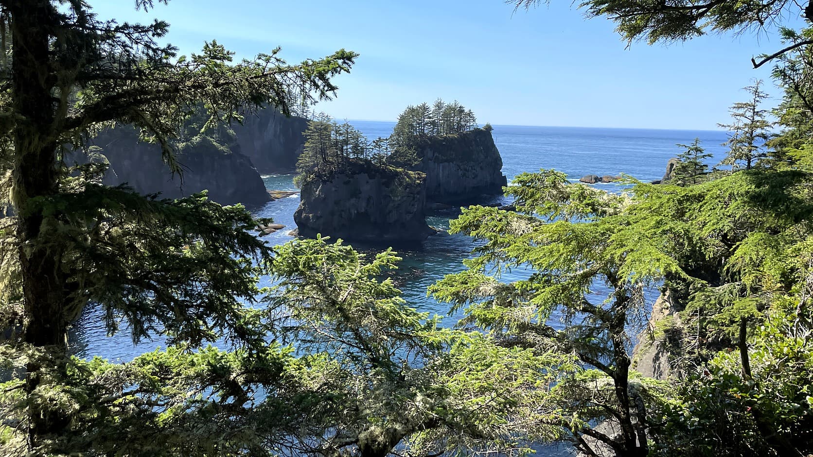
The Cape Flattery Trail permit is a $20 Makah Recreation Pass a vehicle, as of October 2026. Where to buy it, hours, SR 112 work and the drive.
Yes, the Cape Flattery Trail needs a permit, and it comes from the Makah Tribe, not the state. As of October 2026, the tribe's own pages say you need a Makah Recreation Permit, which the tribe also calls a pass, at $20 per vehicle, valid for the calendar year, displayed in the vehicle window. The trail is on the Makah Reservation at Neah Bay, roughly 200 miles and five hours by road from Enumclaw by a routing engine's estimate, so plan it as a long day or an overnight.
The hook is the viewing platform at the far end. From it you look at Tatoosh Island, the rock that HistoryLink says the Makah used as a summer village, with several hundred people living there from March through August. Mail reached the island by canoe, and so, that essay says, did a piano. The 0.75-mile walk to the platform is the short part of this trip.
How much is the Cape Flattery Trail permit?
The tribe's recreation permit page puts the Makah Recreation Pass at $20 per vehicle, valid for the calendar year, and says it must be displayed in the window of the vehicle while you use the trails, beaches and other attractions. The page lists the activities it covers, and sightseeing and hiking are on the list. The page was read on October 28, 2026.
The tribe sets the price and can change it. The page does not say when, so for any date after this one, check the permit page before you drive. Because the pass runs by calendar year, one bought in November, by the tribe's wording, covers only the weeks to the end of December, and a 2027 pass is a separate purchase. The page does not say what that will cost, and this article does not guess.
Where do you buy the Makah Recreation Pass?
In Neah Bay, at the places the tribe lists, or online. The tribe's list names the Makah Marina and the Makah Museum (both listed as open until 5:00 p.m.), Pat's Place, the Makah Mini Mart (7 a.m. to 10:00 p.m. daily), the Financial Services office at the Makah Tribal Center (Monday to Thursday, 8:00 a.m. to 5:00 p.m.), two lodgings, Hobuck Beach Resort and The Cape Resort, and a sales booth near the trailhead. The page also has an online purchase form, and gives an address for questions, rec.permits@makah.com.
The online form is the one way to settle the pass before a five-hour drive. The tribe's page says the permit must be printed and displayed in the vehicle window, that one permit is needed per vehicle, and that a renter without a plate number enters RENTAL on the form and writes the plate number on the permit before arriving. Anyone who cannot print it can show proof of purchase at the Makah Mini Mart. The sale hours above are as the tribe's page gave them on October 28, 2026, and the page's own date stamp is July 2025.
When is the Cape Flattery Trail open, and how hard is it?
The tribe says the trail opens at dawn every day of the year and shuts 30 minutes past sunset. Its length is 0.75 mile from trailhead to overlook, with boardwalks, stairs and dirt sections and an overall elevation loss of 200 feet. The tribe adds that "a moderate amount of exertion is required to get back to the parking lot", so the way down is the easy half. The Washington Trails Association lists the hike at 1.5 miles round trip with 200 feet of gain, and rates it easy by its own formula.
The trailhead has restrooms, day parking and limited RV parking, and the tribe says there are picnic tables near the platform at the end. Camping and overnight parking are prohibited. Daylight saving time ended on Sunday, November 1, 2026, so by the clock the evening closing time now comes an hour earlier than it did in October; look up the sunset for the day you go.
How far is Cape Flattery from Enumclaw?
About 203 miles and 5.2 hours one way by a routing engine built on OpenStreetMap data, with no allowance for traffic, ferries, road work or weather. That figure takes the land route around Hood Canal; it was run for this article from Enumclaw to Neah Bay, not to the trailhead, which is a few more miles on Cape Flattery Road.
The tribe's directions page gives its own figures from Seattle: about 4.5 hours by the Bainbridge ferry and about 4 hours by the Edmonds to Kingston ferry, both "depending on ferries and weather". It says most people come by Highway 112, and the last stretch is the Strait of Juan de Fuca Highway. The Washington Trails Association counts 5 miles west on US 101 from Port Angeles, then 64 miles on Highway 112 to Neah Bay. For a Hoh-sized drive for comparison, the Hoh Rain Forest winter guide works out about the same time by the same method.
One warning comes from the tribe itself: "Google Maps will sometimes advise travelers to use Backtrack Road as the quickest route." The tribe says that leads onto a truck route and eventually gravel roads, and asks visitors to use Bayview Avenue through town.
Is Highway 112 open, and is there road work?
As of October 28, 2026, the Washington State Department of Transportation reports landslide repair on SR 112 west of Clallam Bay near milepost 15.8, toward Sekiu. Temporary signals take turns letting each direction through, day and night, and the posted speed falls from 40 to 25 mph for about a third of a mile. I found no full closure.
The agency's two pages disagree on the end date. Its August 13 news release expects all work done by the end of October, while the project page says the temporary changes "will remain in place until mid-to-late November." Expect the lights on a drive early in November, and add time. WSDOT's travel alerts and mobile app are the place to look the morning you leave, and the tribe calls the highway the most common way in.
Can you bring a dog, and what are the rules?
Dogs are allowed on the trail on a leash, the tribe says, and visitors and pets must stay on the main trail. There are no garbage cans along it, so you carry your litter out. The tribe asks every visitor to practice Leave No Trace.
Several of the tribe's rules reach past the trail. Its notices page says the tribe prohibits drones on the reservation, and that beachcombing and gathering drift material is prohibited for anyone who is not a tribal member or family. Commercial film and photography need a location agreement; personal photos do not. The same page opens with a plain statement: "The Makah Tribe is a separate sovereign." The permit page asks visitors to "respect the culture of the Makah Tribe and limit your activities to designated visitor facilities."
What are you looking at from the end of the trail?
Tatoosh Island, about half a mile offshore, a 20-acre rock that HistoryLink describes as an extension of the cape, joined to it under water by ledges. The tribe's trail page tells visitors to look for gray whales out from the cape, and for sea lions on a rock it names Snake Rock, just east of Tatoosh. That is the tribe's suggestion; nothing guarantees a whale, and the light changes with the weather.
The island carries a lighthouse, first lit on December 28, 1857 by HistoryLink's account. That essay says the Makah resented its building and interfered with the work, and that the builders, armed with 20 muskets, put up a blockhouse first. It also records that settlers of the time believed the Makah had given up Tatoosh under the 1855 treaty, and that the Makah "apparently did not see it that way." None of the tribe's pages opened for this article offers a visit to the island, and sources I found differ on who holds the lighthouse now, so this page states neither. The trail is a viewing platform, not a landing. If you want a lighthouse you can walk up to, the Washington lighthouse guide lists eight with their published hours.
Can you visit the Makah Museum the same day?
It is open 7 days a week, 10 a.m. to 5 p.m., the tribe's museum page says, and closed on New Year's Day, Thanksgiving and Christmas; it adds that the museum may close in harsh weather, and gives 360-645-2711 for questions. Admission as of October 2026 is $10 for adults, $8 for students, seniors 62 and older and uniformed military, and free for children 5 and under.
The museum shows artifacts from the Ozette Archaeological Site, a Makah village the tribe says was partly buried by a mudslide 300 to 500 years ago and discovered in 1970. The tribe's home page says about 1 percent of the recovered artifacts are on display. The museum also sells the recreation pass, which makes it a practical first stop on the way to the trail, if it is open when you arrive.
Before you go
Check three things the day you leave: the pass on the tribe's permit page, SR 112 on WSDOT's travel alerts, and the weather. Buy the pass before the trailhead if you can. The online form on the tribe's page asks for an email address, a phone number and the vehicle's license plate number, and questions go to rec.permits@makah.com.
Fuel is available in Neah Bay, the tribe's directions page says, but plan the day around daylight, because the trail closes 30 minutes after sunset and the drive home is as long as the drive out. If the day is too much, the Deception Pass State Park guide works out a different park's pass and winter hours. For the Pacific shore in season, the razor clam digs guide covers the state's published dig rules and dates.
Story label: Original Story or Guide
Originally published: