

Feature
Mount Si in winter, the Discover Pass and the parking
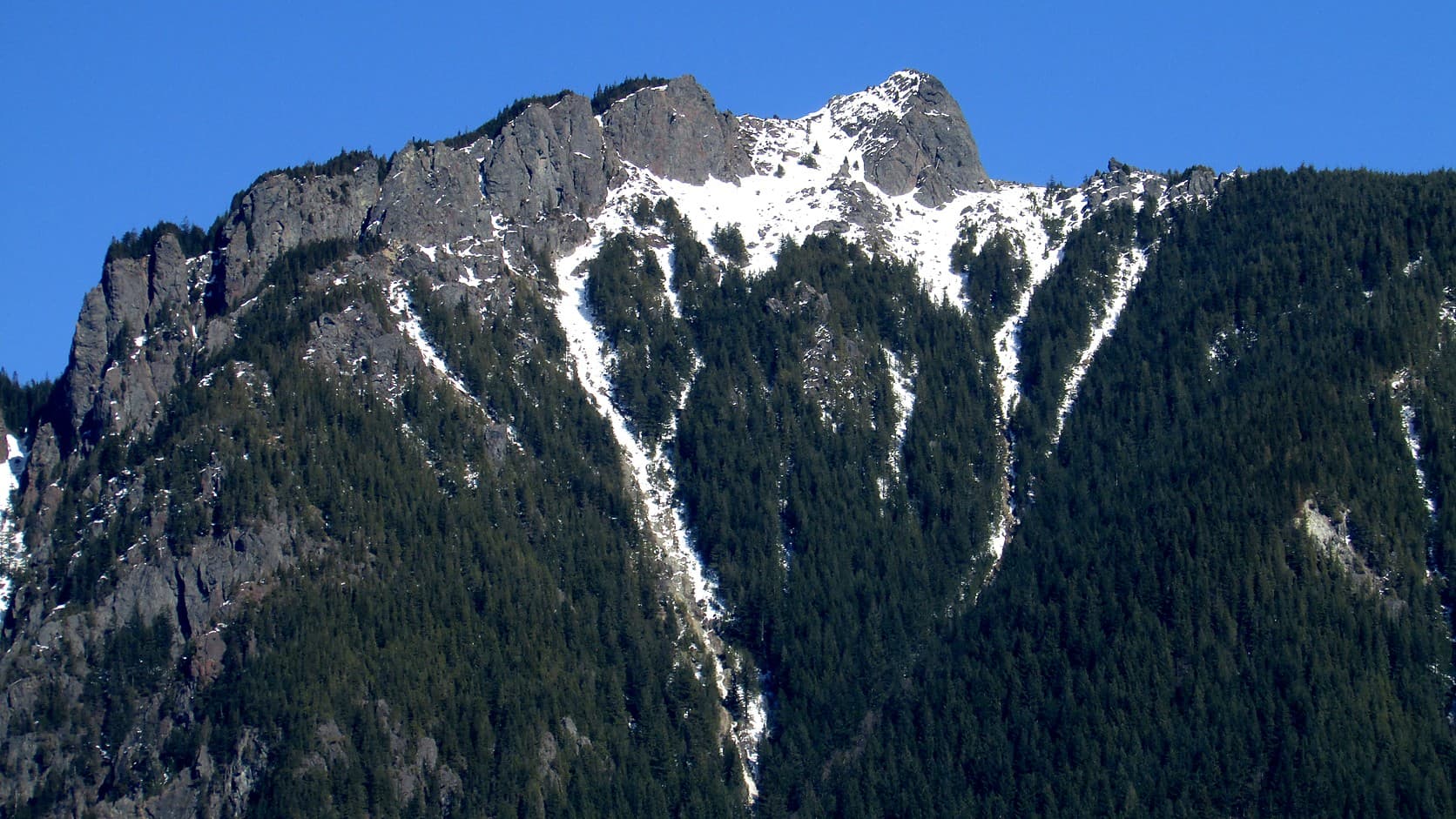
Mount Si in winter: DNR lists no closure and requires a Discover Pass to park ($45 a year, $10 a day, as of Oct 2026). Hikers' reports on snow and parking.
Mount Si has no winter closure on the page of the agency that runs it, and the rule that does not change with the weather is the parking. As of October 2026, the Washington Department of Natural Resources (DNR), which manages the Natural Resources Conservation Area around the mountain, says "A Washington State Discover Pass is required for parking at the Mount Si NRCA and the Little Si Trailhead at Mount Si NRCA." A pass costs $45 for a year or $10 for a day, and the trailhead is about 37 miles and an hour's drive from Enumclaw by mapping software.
The mountain is less predictable than the rule. Hikers' reports on the Washington Trails Association (WTA) site for winter 2025 to 2026 run from a mid-January writer who found "No snow on Mt Si in January" to a mid-March hiker who found "Lots of fluffy snow from parking lot onwards." That is the same 3,150 feet of climbing, about eight weeks apart, with two different mountains at the top of it.
Do you need a Discover Pass for Mount Si?
Yes, if you park a motor vehicle at the Mount Si or Little Si trailheads. The Discover Pass site describes the pass as a parking pass, so a person who arrives on foot, by bicycle or by any other means without a motor vehicle does not need one. WTA adds a warning for drivers: it says the lot is patrolled regularly, so do not assume no one will check.
The price and the penalty are set by state law, not by DNR. RCW 79A.80.020 names the price at $45 and has the state's budget office review it every four years and recommend any change to the Legislature, so check the price on the State Parks Discover Pass page before you buy. That page lists the one-day pass at $10 and says a single pass may cover two vehicles, though only one at a time.
The pass has to be displayed in the front windshield. Under RCW 79A.80.080, parking without one is a natural resource infraction with a $99 penalty, cut to $59 if you show proof that you bought a pass within 15 days of the notice. You can buy a pass when you renew your vehicle licence, by phone, or at fishing and hunting licence vendors.
Two things differ in winter. A Sno-Park permit is a separate pass for designated winter parking areas, and the Discover Pass is not valid there; our Sno-Park permit guide has the rules. And on the state's free days no pass is needed: the 2026 list on the Discover Pass site ends with Veterans Day, November 11, 2026. State law lets the State Parks director designate up to 12 a year, so look for the 2027 list rather than assume one. Our guide to which pass works where near Enumclaw covers the other agencies.
Is Mount Si open in winter?
On DNR's page, yes. It lists the area as day use only, gives no clock hours and no seasonal closure, and carried three recreation alerts on October 26, 2026.
The first says the Mount Teneriffe Trailhead "will be closed on Thursday, October 22 during hazard tree removal," with all trails and nearby trailheads remaining open. That date has passed and no reopening notice was found, so check the page. The second closes the bathroom at the Oxbow Loop Trailhead, a different trailhead from the main Mount Si lot, from October 1, 2026 until April 30, 2027, which DNR attributes to state budget reductions. The third is a caution about bears.
Day use matters more in winter than it sounds. Clocks fall back on Sunday, November 1, 2026, as our daylight saving time guide explains, and WTA's winter safety page tells hikers to carry a headlamp because the days are short. An 8-mile hike that ends at dusk in July can end after dark in December.
How much snow is on Mount Si in winter?
It depends on the week, and no agency page opened for this article reports trail conditions. What follows are hikers' accounts on WTA's site, dated, not conditions you can count on.
On December 21, 2025, one hiker found the trail snow-free until about 3,000 feet, then slushy, with more snow about a third of a mile from the top. On December 29, 2025, another reported many hikers slipping on melting, slushy snow in the last mile or so, and one person turning back for lack of traction. The January 16, 2026 report quoted above found the mountain drier than the writer had ever seen it that time of year. A February 16, 2026 report described snow and ice over about the last quarter mile and advised cleats. The March 14 report quoted above found snow from the lot, and on April 16, 2026, a hiker found snow about a foot deep at the lookout.
In these reports the snow was mostly on the upper part of the trail, though on March 14 it began at the parking lot and on April 16 after the first wet mile; WTA lists 3,900 feet as the hike's highest point, below the Haystack, the true summit. WTA's winter safety page lists the Ten Essentials, the standard hiker's kit, and singles out extra clothing, extra food and an emergency shelter for winter. Its advice for a bad day is short: "It's okay to turn back."
Is there parking at Mount Si, and does it fill up?
There is a lot at the trailhead, DNR gives no space count, and the reports disagree about how full it gets. WTA says the lot overflows on any nice day and many a not-so-nice one, and that upwards of 100,000 people hike the trail each year. A hiker's report from October 24, 2026 says the lot was never more than about a quarter full all day. A January 31, 2026 hiker estimated 100 to 120 spaces and said the lot fills up fast.
The surface is the other complaint. Hikers' reports from February to October 2026 return again to potholes at the lot entrance, and one writer on April 28, 2026 said the ruts had been there for years. An October 2, 2026 report repeats a warning that they are "bathtub size" and says that was no exaggeration. DNR's page does not mention them, so treat that as hikers' testimony, and drive slowly.
How hard is the Mount Si hike, and what about Little Si?
WTA rates Mount Si Hard: 8.0 miles round trip, 3,150 feet of elevation gain and a highest point of 3,900 feet. Its description says most hikers turn around at a talus slope, a field of broken rock, with views to Mount Rainier on a clear day, and calls the last stretch to the Haystack, the true summit, a rough scramble.
If that is more than the day allows, Little Si is on the same road and under the same pass rule. By WTA it is 3.7 miles round trip with 1,300 feet of gain, topping out at 1,550 feet, rated Moderate. WTA says both Little Si lots, a main one and an overflow, may be full on weekends. Our Rattlesnake Ledge winter guide covers another North Bend hike and its own winter rules.
How do you get to Mount Si from Enumclaw?
By road, about 37 miles and roughly an hour by a mapping service, which will vary with traffic on I-90. DNR's directions, the same from either direction on I-90: take Exit 32 at North Bend, turn north onto 436th Avenue, turn left at the T onto North Bend Way, and after one-third of a mile make a right onto Mt. Si Road. DNR puts the Mount Si trailhead at approximately 2.5 miles on the left. WTA says three-tenths of a mile and 2.4 miles, so treat both as approximate. The Teneriffe trailhead is about a half-mile farther.
WTA advises saving a copy of the directions before you leave, because app directions are not always accurate. If you are heading to the falls instead, their lots follow different rules, set out in our Snoqualmie Falls parking guide.
What is the history of the Mount Si trail?
DNR says the conservation area was one of the first established, in 1987, and covers 13,735 acres with four peaks: Mount Si, Mount Teneriffe, Green Mountain and Little Si. WTA's page says 1977; DNR manages the land, so 1987 is used here.
WTA says Mount Si was home to mining and logging before the conservation area, and that the trail was once a 4x4 track. DNR says it partnered with Mountains to Sound Greenway Trust and volunteers in 2005 and 2006 to renovate the trail after decades of hiking had caused erosion. At the start is a tribute to Frances North, whom WTA calls a pioneering state legislator and the person most responsible for protecting the mountain; that claim is WTA's, and no other source opened for this article confirms it. DNR lists a .2-mile barrier-free Frances North Loop Trail at the base, but does not say whom it honours.
Can you bring a dog to Mount Si?
Yes, on a leash, by both DNR and WTA. DNR also says garbage service is not provided, so pack out what you pack in, and WTA asks hikers not to feed the gray jays and chipmunks at the lunch spot. With DNR's bear alert posted, read the state's advice before you go.
Before you go
Check three pages on the day. DNR's Mount Si NRCA page settles the pass, the day-use rule and any closure or reroute,. WTA's Mount Si trip reports are the dated record of snow and ice, and they should be read by date. The State Parks page above has the current pass price and any free days.
Everything about the snow is a reading of other hikers' reports, so pack for the top of the trail, and turn back if it asks too much.
Story label: Original Story or Guide
Originally published: