

Feature
Rattlesnake Ledge in winter: parking, the pass and the ice
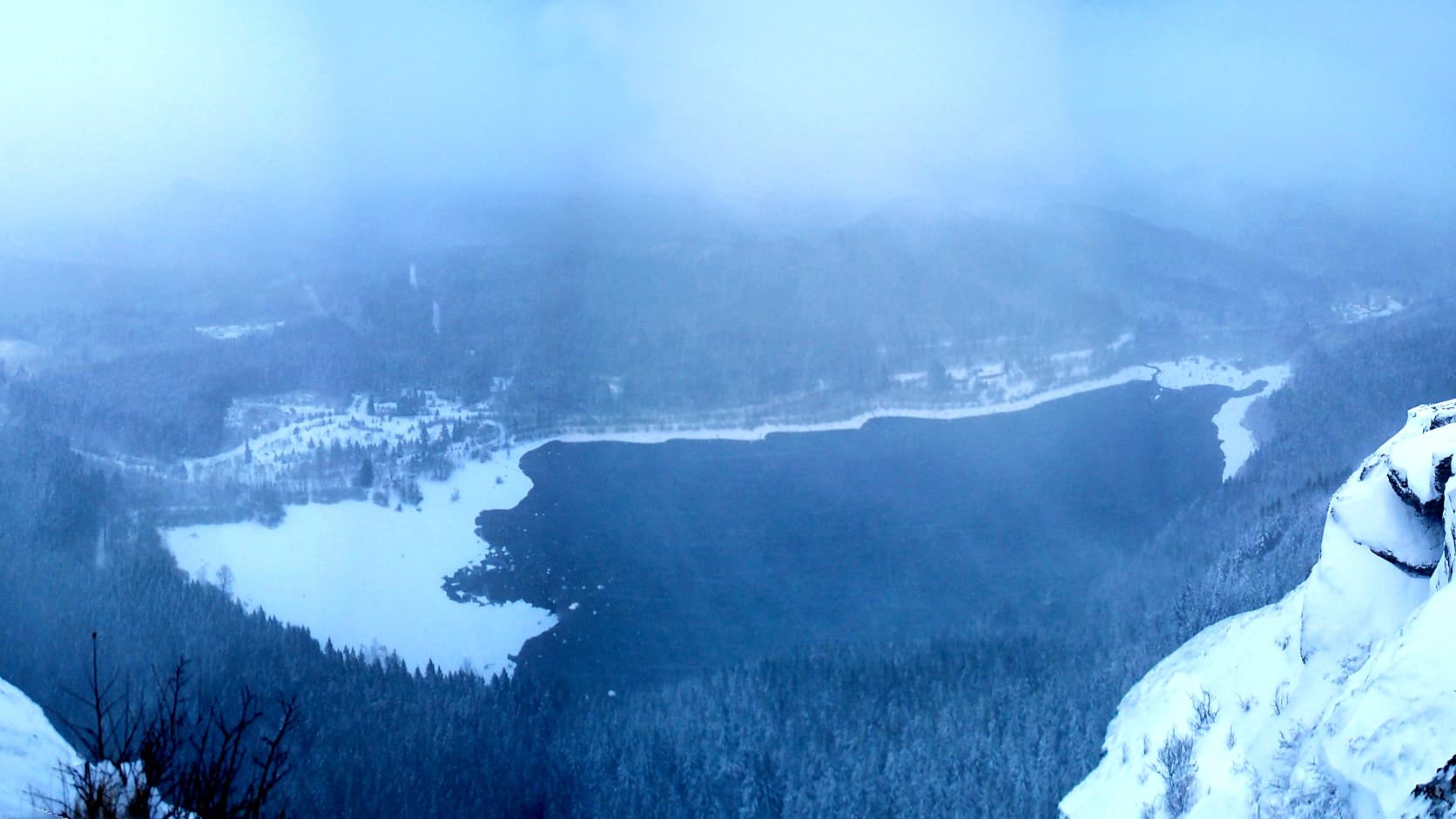
Rattlesnake Ledge in winter: Seattle lists parking as free, DNR says a Discover Pass is required. What each covers, the ice, the hours, the drive.
Rattlesnake Ledge, near North Bend, is open in winter. As of October 2026, Seattle Public Utilities, which owns the lake and the lot at the trailhead, lists the recreation area as "Open dawn to dusk, year-round. Parking is free." The ledge is 2 miles up the trail, about 37 miles and an hour's drive from Enumclaw by mapping software, and the same page says to "Expect winter conditions through April." The ice, not the distance, is what hikers' reports and the sheriff's office point to.
The lot belongs to Seattle's water utility, not to the state, and the utility lists parking as free, while the state's own page for the area says a Discover Pass is required. The King County Sheriff's Office has said, in reports from March 2018, that on average two people a year fall from this ledge. That month a 16-year-old lost his footing on ice on a sunny Saturday.
Do you need a Discover Pass for Rattlesnake Ledge?
For the city's lot at Rattlesnake Lake, the city that owns and manages it lists parking as free: Seattle Public Utilities' page says so, and the Washington Trails Association's Rattlesnake Ledge page lists no parking pass or entry fee. The Department of Natural Resources page for the Rattlesnake Mountain Scenic Area says "A Washington State Discover Pass is required for parking." It does not say which lots that sentence covers.
The state and King County co-own the scenic area, which is the ridge and the trail system. DNR's page says the Rattlesnake Ledge Trail starts at "the City of Seattle's parking area at Rattlesnake Lake," and that the Rattlesnake Mountain Trail starts at Snoqualmie Point Park, off I-90 exit 27. In June 2014 the Snoqualmie Valley Record reported that the upper lot beside Snoqualmie Point Park required a pass because it serves the Rattlesnake Mountain Trail on state land. DNR's page puts its pass sentence right after the trailhead directions, including those ending at the Rattlesnake Lake parking area, and does not say which lots it covers. The Record's report fits a pass line aimed at DNR's own trailheads, but that is a reading, not a ruling, and Seattle lists the lake lot as free.
A third place does need one. Seattle's page says the Cedar Falls Trailhead at the lake, the western end of the Palouse to Cascades State Park Trail, requires a Discover Pass. One hiker's February 2026 report on the trails association's site describes a small lot of about ten cars outside a gate where the writer says a pass was required. The report does not say whose lot it was, and no agency page confirms it, so read the sign. A pass cost $45 for a year or $10 for a day as of October 2026, per State Parks' Discover Pass page; our guide to which pass works at which park near Enumclaw has the rest.
What time does the Rattlesnake Ledge parking lot open and close?
The city's rule is dawn to dusk, every day of the year, with no clock hours given. In midwinter dusk comes in the afternoon. The lot is also small. The same page warns that "weekend trail use is heavy year-round and parking is limited at Rattlesnake Lake."
There is a gate to know about. As of October 2026, the Cedar River Watershed Education Center's page lists its access gate as open every day from 6 a.m. to 6 p.m. A hiker's report from February 2026 found "gates still closed at 6am" on a sunrise climb. Seattle's recreation page does not mention a gate time, so if you plan an early start or a late return, call the center at 206-733-9421 first.
How long and how steep is the hike?
Two miles to the ledge, 4 miles round trip, with a climb of about 1,160 feet to 2,078 feet above sea level, by the trails association. DNR's page rounds the same trail to a climb of "nearly 1,000 feet" to a viewpoint at "nearly 2,100 feet." The agencies round differently. Seattle rates the trail moderate to difficult.
No official page gives a time. One hiker's log on the trails association's site recorded 90 minutes for a mid-morning round trip in February 2026 and two and a half hours for a sunrise trip that turned back early in the cold. Treat that as one person's pace, not a rule.
Is Rattlesnake Ledge safe in winter?
It is open, but it is not a flat lowland stroll in January. Hikers' reports on the trails association's site for January 14 and 15, 2024 describe packed snow from the trailhead and "a few spots where it's sheer ice (around creeks)," with one writer saying microspikes, the strap-on metal traction for boots, were needed. Another report, from February 2026, found the trail muddy and the ledge "very slippery" with almost no snow. Conditions swing week to week, so Seattle advises carrying the 10 Essentials, the standard hiker's kit, and to "use extreme caution around exposed cliffs and steep drops."
The record of falls is short and plain. On March 9, 2012, a 32-year-old man fell down a cliff on the trail, a hiker who saw it called the sheriff's office around 4:45 p.m., and he died, the Snoqualmie Valley Record reported. On Saturday, March 3, 2018, a 16-year-old fell about 600 feet. King County deputies told KOMO he lost his footing on icy terrain, and Sgt. Ryan Abbott of the King County Sheriff's Department said that near the top, "it's such a high elevation and can be icy." It was a clear day. The boy is not named here.
The yearly figure comes with a caveat. KIRO 7 reported in March 2018 that the sheriff's office says "on average, two people fall to their deaths on Rattlesnake Ledge each year." KOMO's version of the same statement is that deputies said about two people fall off the ledge each year. No published count behind either version turned up, a search for fatal falls since 2018 found none, and an absence in a search is not a count. That wording is in KIRO 7's March 3, 2018 story.
If the ice is more than you want, a winter day on the south side of Mount Rainier is another option, and our guide to Mount Rainier in winter explains the one road that stays open.
Is Rattlesnake Ledge closed?
Not on any page opened for this article. The city's recreation page carries one notice, dated August 2025, which suspends special use permits for activities or gatherings of more than 30 people while Seattle Public Utilities writes a recreation strategic plan. That affects weddings and organized events, not a hiker. DNR's page lists no closures.
The closure that does come up in winter is next door. Seattle's page says the Snoqualmie Pass tunnel on the Palouse to Cascades trail is closed from November 1 through May 1. The tunnel is a different trail, east of the lake.
Can you bring a dog or fly a drone?
A dog, yes, on a leash. DNR's page says "Dogs allowed on leash," the trails association says the same, and Seattle's page asks hikers to keep pets leashed and warns you will meet "many hikers and dogs." Drones, no: Seattle prohibits quadcopters, drones and model airplanes at the recreation area. Hunting is out too. DNR says the scenic area is closed to hunting, and Seattle's page says hunting and gathering are prohibited at the lake, which matters in the fall seasons our hunting dates for Washington hikers explain.
How far is Rattlesnake Ledge from Enumclaw?
About 37 miles and 58 minutes by OpenStreetMap-based routing from the middle of Enumclaw to the lake lot, which is an estimate, not a promise. The trails association and DNR give the same turn: take I-90 exit 32 and go south on 436th Avenue SE, which becomes Cedar Falls Road SE. The trails association puts the lot about four miles along on the right, DNR says 3.1 miles, so watch for the lake. The trails association warns that map apps that route you to 208th Avenue SE in Hobart lead to a road that "now dead ends 7 miles down the road."
If the roads are slick, remember the dates. Studded tires are legal in Washington from November 1 through March 31, as our explainer on Washington's studded-tire rules lays out.
The town under the lake
The lake you look down on is partly a mistake. HistoryLink's essay on Moncton says Seattle began a masonry dam in 1914 upstream of the lake, to power City Light. By spring 1915 water was seeping through the glacial moraine beneath it, and the lake rose a little over a foot a day in May. Moncton, a railroad village on the shore with more than 200 residents, a hotel, a school and an indoor swimming pool, went under. Seattle condemned the town and paid its owners $47,658.03, and the next year workers burned what was left.
The Washington Trails Association says the water is often low enough to show foundations, stumps and an old fireplace, usually in fall. The lake is 111 acres, by Seattle's count, and the education center on its south shore lists free exhibits. Another 1910s water scheme sits closer to home: the White River diversion at Buckley.
Before you go
Check Seattle Public Utilities' Rattlesnake Lake page the morning you leave for notices, and call the Cedar River Watershed Education Center at 206-733-9421 if you are unsure about gate or trail conditions; Seattle says the center can answer trail-condition questions. Read the latest trip reports on the trails association's page before committing to the ice. Pack traction for boots, a headlamp and the 10 Essentials, plan to be back at the car by dusk, and read the sign at whichever lot you choose. Seattle lists no drinking water at the lake, only at the education center.
Story label: Original Story or Guide
Originally published: