

Feature
Dungeness Spit lighthouse walk, tides and fee
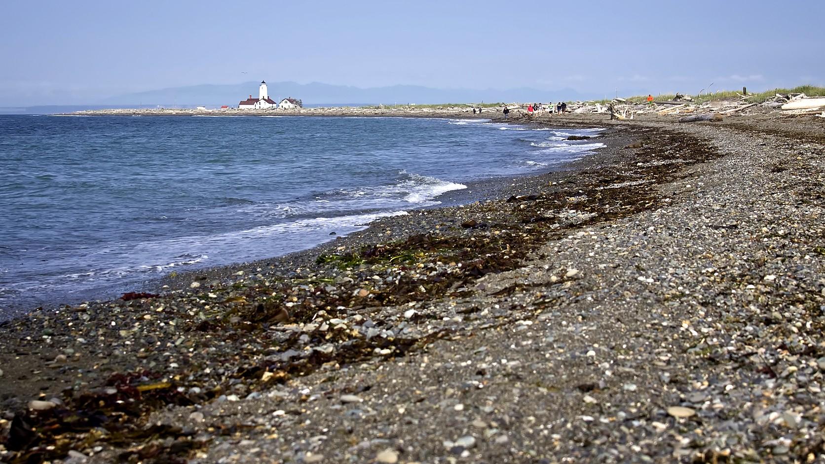
Dungeness Spit lighthouse walk: about 5.5 miles each way, a $3 group fee as of November 2026, and the tide rule the lighthouse volunteers give.
The Dungeness Spit lighthouse walk is about 5.5 miles each way, 11 miles there and back, over shingle and sand with no shelter and no ride home, and the tide decides how hard it is. As of November 2026 the U.S. Fish and Wildlife Service, which runs Dungeness National Wildlife Refuge near Sequim, charges $3 per family or party of up to four adults, with children under 16 free, and the refuge is open daily from sunrise to half an hour before sunset. From Enumclaw it is roughly 121 road miles, about three hours without traffic by a routing service.
The lighthouse at the end is not quite the one first lit in 1857. By the lighthouse association's history, the tower was cut down by 27 1/2 feet in 1927, and the lantern on top was taken from another lighthouse that had been abandoned. The walk itself is along one of the longest sand spits in the world, by the refuge's description.
How long is the Dungeness Spit lighthouse walk?
Plan on about 5.5 miles each way and 11 round trip, which is the Service's figure on its page for the light station. That is a forest trail of about half a mile (the Service's trails page measures the Main Trail at 0.63 mile) from the parking lot down to the beach, then five miles along the spit. The Service's trails page lists only the spit at 5 miles, 10 round trip, so the two numbers do not conflict: one leaves out the forest trail.
The New Dungeness Light Station Association, the volunteer group that looks after the lighthouse, says to allow about two hours each way, five hours in all, plus time to rest at the far end. It adds that nothing shelters walkers before the lighthouse and no transport back other than on foot. In the short days of winter, five hours of walking must fit before the refuge's closing time, so the time posted at the trailhead matters as much as the tide.
What is the tide rule for the lighthouse walk?
Walk it at low tide. The association puts it flatly: "Attempt the hike only at low tide." It says a high tide means scrambling across driftwood logs, which can stretch the trip by hours, and that on the rare occasion a storm breaches the spit, the lighthouse is cut off as an island until the water drops again. On its tide page it recommends arriving at the lighthouse at low tide.
The Service sends hikers to the same tide table and adds a warning about the beach itself: "Even at low tide, keep your eyes on the ocean and the beach logs." Driftwood logs, it says, are heavy and unstable and can move unexpectedly.
Neither agency prints a rule about falling or rising tide, but the association's numbers give one. If the walk out takes about two hours and the goal is to reach the lighthouse at low tide, you leave the parking lot roughly two hours before the low, which means walking out on a falling tide. That is arithmetic on the association's figures, not a rule either group states, and it puts the return on a rising tide, so check how much beach the table leaves you when you start back. The association publishes tide charts for 2026 and 2027 on its tide chart page. NOAA also lists a Dungeness station, but it is a derived one: its predictions are worked out from Port Townsend's with fixed time and height offsets, and NOAA's listed coordinates put it about a mile from the lighthouse in a straight line, not at it. No tide time for any day is printed here, because a printed time is wrong by the next tide. This site's Rialto Beach tide rule explains how to read a NOAA table, which works the same way here.
How much does it cost to walk Dungeness Spit?
As of November 2026 the refuge's rules page sets the entrance fee at $3 a day for a family or party of up to four adults, with children under 16 free. It takes cash or check and asks for exact change. An annual Dungeness refuge pass is $12 on the same page. The Federal Recreational Lands Pass, a Senior, Access, Military, Volunteer or Every Kid in a Park pass, and a Federal Duck Stamp each admit a party of up to four adults too, and passes other than the duck stamp are sold at the refuge office.
The Service sets the fee and can change it, so read the refuge's Visit Us page before you go. The association says there is no charge at the lighthouse, although donations to its upkeep are welcome.
Can you go up the lighthouse?
Sometimes, and the hours are the thing to check. Both the Service and the association say volunteer keepers give free tours of the museum and the tower from 9 a.m. to 5 p.m. daily. The Service adds that winter hours vary, and its light station page says they are reduced in winter. Neither page says what the winter hours are, so this page cannot.
The climb is 74 steps, the association says, to the lantern room. Visitors may not step outside onto the gallery, the narrow walkway around the lantern. At the lighthouse there are picnic tables, a drinking fountain and a restroom, and no food or drink for sale. The association's phone is (360) 683-6638 and the refuge office's is (360) 457-8451, open Monday through Friday from 8 a.m. to 4:30 p.m.
Can you take a dog or a bike on Dungeness Spit?
No to both. The refuge bars pets, and it lists bicycling, kite flying, ball games, Frisbees, flying machines, fires and camping among prohibited activities. Jogging is not allowed on the spit either, to protect wildlife. Walkers keep to the spit's north shore, below the boundary markers; the south side and the ground beyond the lighthouse are closed, as are Graveyard Spit and the bluffs, which the Service calls unstable and extremely hazardous. Harbor seals and their pups rest on the refuge's shores, and the Service says not to approach them.
Why is it called Dungeness Spit?
An English captain named it after a place at home. The Service says George Vancouver anchored HMS Discovery near the spit on April 30, 1792, and named it for the Dungeness headland on the south coast of Kent, which it resembled in his eyes. He did not know the Spanish explorer Manuel Quimper had already called it Punta de Santa Cruz two years earlier. Vancouver's name was the one that stuck.
The refuge was set aside by executive order on January 20, 1915, as a "refuge, preserve and breeding ground for native birds," the Service says. The lighthouse's lamp was first lit on December 14, 1857, and the association calls it the first one finished on the Strait of Juan de Fuca. The light was automated in May 1976, and after the last Coast Guard keepers left in March 1994, the association formed that September and took on the station under a Coast Guard licence. It says it gets no money from any government agency, and that its volunteers have given more than 100,000 hours since 1994.
The replacement lantern came from the Admiralty Head Lighthouse on Whidbey Island, one of the towers this site covers in its guide to Washington lighthouses you can visit. The crab that shares the place name has its own rules in the Dungeness crab season guide, which covers Puget Sound, not this strait.
How far is Dungeness Spit from Enumclaw?
About 121 miles by road and close to three hours, by the OpenStreetMap-based routing engine OSRM, with no traffic. Its route runs State Route 164, State Route 18, Interstate 5, State Route 16 across the Tacoma Narrows, State Route 3, State Route 104 over the Hood Canal Bridge and U.S. 101 toward Sequim, with no ferry. Treat the figures as approximate, and check WSDOT alerts the morning you leave, since a closure on a bridge or a pass changes the answer. If you would rather cross Puget Sound by boat, the Washington State Ferries sailing seasons change on set dates, which this site's ferry sailing seasons guide lays out.
The refuge's directions are from U.S. 101 about three miles west of Sequim: north on Kitchen-Dick Road, left into the county's Dungeness Recreation Area on Voice of America Road, and on through it to the refuge lot. For a navigation app the Service gives 600 Voice of America Road, Sequim, and warns against using the refuge's mailing address, which will not get you there. Camping is not allowed on the refuge; the Service points to the adjacent county recreation area.
Before you go
Check four things on the day. Read the tide table for a low that lets you reach the lighthouse near the bottom and still get home with beach under your feet. Look at the closing time posted at the trailhead, because the refuge shuts half an hour before sunset and the association says walkers have to leave the refuge by sunset. Check the weather, since the association says there is no shelter until the lighthouse. And call about tower hours if climbing is the point.
Wear shoes that handle shingle and logs, and bring exact change or a valid pass for the entrance fee. The Service and the association set the hours and can change them, so the New Dungeness Light Station Association's hiking page and the refuge's pages are the places to confirm them. For a gentler national wildlife refuge nearer home, this site's Nisqually refuge guide covers a boardwalk where the tide also shapes the day.
Story label: Original Story or Guide
Originally published: