

Feature
Rialto Beach and Hole-in-the-Wall, and the tide rule
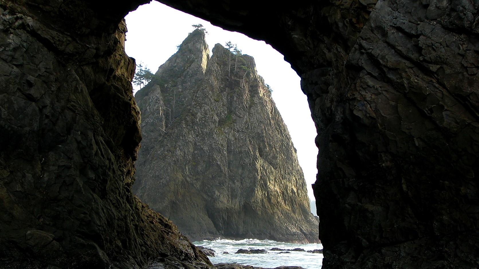
Rialto Beach Hole-in-the-Wall tide rule: the park says not to cross once the tide begins to cover the arch floor. Read NOAA's La Push table, plus the drive.
Rialto Beach, near Forks on the Olympic coast, is about 200 miles and a little under five hours by road from Enumclaw, and Olympic National Park rates the beach walk to the Hole-in-the-Wall sea arch as easy. The tide, not the trail, decides whether you can use the arch: the park says not to cross through it once the tide begins to cover its floor. As of October 2026 the park's conditions page lists Mora Road as open, and a private vehicle needs a $30 entrance pass.
The park's own pages do not agree on how far the arch is. One says 1 mile, two say 1.5, and one of those adds an hour on foot. A Rialto Beach page also still says Mora Road is shut for construction through October 15, 2026, while the conditions page says it is open. Both are sorted out below, along with the table that tells you what the water will do.
How far is the walk to Hole-in-the-Wall?
Plan on 1 to 1.5 miles each way along flat beach. The Rialto Beach page says "1 mile to Hole-in-the-Wall camp area" and lists no elevation change. The Mora and Rialto page puts the arch about 1.5 miles north of the beach, and the tidepool page says 1.5 miles from the trailhead, about an hour. The pages do not explain the gap. The first measures to a camp area and the others to the arch, which may account for it.
The Rialto page lists one river crossing on the way, Ellen Creek, and says there are numerous campsites between the creek and the arch. It tells coast walkers to bring a topographic map and a tide chart.
What is the tide rule at Hole-in-the-Wall?
The park's tidepool page puts it in one line: "Do not cross through Hole in the Wall when the tide begins to cover the floor of the arch." The same page says to arrive at least 30 minutes before the lowest tide, counting the hour it takes to walk in from the parking area, and calls the arch a good place for tidepools during low tides.
The Mora and Rialto page states the risk in general terms: "It's possible to get stranded when certain areas of the coast become impassable when high tide rolls in." The tide-safety page adds that several points on the coast are passable only at lower tides, and that at some times of year higher tides block places in daylight, sometimes for days at a stretch.
The park gives no clock time for the arch, and neither does this page. No tide time for any particular day appears here, because a printed time is wrong by the next tide. Read the day's figures from NOAA's table, as described next.
How do you read the La Push tide table?
Open NOAA's tide predictions for La Push, Quillayute River, WA, station 9442396, choose your date and find the low tide you plan to use. The park's tide-safety and alerts pages link to this station. Its tidepool page points to Destruction Island tide charts instead, so ask a ranger if you want to know which they prefer for the arch.
Heights are in feet from a zero NOAA calls mean lower low water. NOAA defines it as the average of the lower of each tidal day's two lows over a set reference period, and says it is the reference for its predictions. A height below zero, written with a minus sign, means the water drops below that average, which is what people mean by a minus tide. The park's tidepool page suggests aiming for tides under 1 foot for tidepooling and says a 3-foot low is not great for it.
The station is old. NOAA's page says it was established on December 19, 1924, and lists a minimum water level of minus 3.59 feet on May 7, 2008. Those are history, not a forecast. The page labels its times as local standard time, so check the label on whatever table you print.
Can you go to Hole-in-the-Wall in November?
You can, but the park's Rialto Beach page lists April through October as the best season for the route, and its alerts page carries a coastal caution. It reads, "Fall brings higher high tides, which can be dangerous and will cover some coastal routes completely." It also warns of sneaker waves, which surge up a beach farther than the waves before them, and of beach logs that tides can move unexpectedly.
The tide-safety page says strong winds or storms can raise tides significantly, particularly in fall, winter and spring, and suggests checking NOAA's marine forecast before a coastal hike. This site's explainer on atmospheric rivers in Washington covers one kind of heavy-rain storm that reaches the coast.
Is Mora Road open?
As of October 2026, yes, by the park's conditions page, which lists Mora Road and Mora Campground as open and was read on October 28, 2026. The Rialto Beach page, last updated July 31, 2026, still carries a notice that the road is shut to every kind of traffic, walkers and cyclists included, for construction through October 15, 2026. That date has passed, and the conditions page lists no closure.
The park says Rialto Beach is reached by Mora Road, off La Push Road. It does not say whether more road work is planned, so call the Road and Weather line at 360-565-3131 before you leave. The park says Olympic is open around the clock all year. From October through May, it adds, some roads and campgrounds close or cut hours, and any can close for weather or construction. It lists no winter closure for Rialto itself.
How far is Rialto Beach from Enumclaw?
About 200 miles and a little under five hours one way. That comes from a routing engine built on OpenStreetMap data, which returned 200 miles and 4 hours 54 minutes from Enumclaw to the end of Mora Road, with no allowance for traffic, bridge openings, road work or weather. It chose State Route 16 over the Tacoma Narrows, State Route 3, State Route 104 across Hood Canal and US 101 around the north of the peninsula, then State Route 110. Forks, under half an hour from the beach by the park's account, is the nearby town where the park points visitors for lodging.
The two right lanes of the westbound Tacoma Narrows Bridge and the Jackson Avenue on-ramp reopened at 11:40 a.m. on October 30, 2026, according to WSDOT's updated repair notice. The work finished a week ahead of the planned November 8 reopening. Check WSDOT's travel alerts for the full route the morning you drive.
That route does not cross the US 101 bridge over the Hoh River, which this site covers in its guide to the Hoh Rain Forest in winter. The park lists the Hoh within an hour's drive of Rialto, so that guide matters if you carry on south.
Do you need a pass for Rialto Beach?
Yes, an entrance pass of some kind. The fee page says, "All visitors must have one of these entrance passes." As of October 2026 a private vehicle pass is $30, valid for seven consecutive days and covering everyone in the vehicle. A person on foot or a bicycle who is 16 or older pays $15, and an annual Olympic pass is $55. The park does not accept cash, and an America the Beautiful pass covers entrance.
The Park Service sets these prices, and the fee page, last updated December 19, 2025, is where changes appear. It lists November 11, 2026, Veterans Day, as a fee-free day for U.S. citizens and residents. It does not say where payment is collected on the Mora side, so settle that before the long drive. For how passes sort out nearer home, see this site's pass-by-pass guide for Enumclaw.
Can you bring a dog or camp overnight?
Dogs on a leash may go up the beach as far as Ellen Creek, 0.8 mile north, in daylight only, and the park bars pets from camping. By the park's distances that is short of the arch, and the tidepool page says not to bring dogs onto tidal rocks, where sharp stone, barnacles and mussels can cut paws.
Overnight stays need a Wilderness Camping Permit, booked online through Recreation.gov. As of October 2026 the fee page lists $8 per person per night plus $6 per permit, with no charge for anyone 15 or under, who still count toward the group limit of 12. Food and scented items go in park-approved bear canisters, fires are allowed only in existing rings, and firewood means driftwood. The park says to camp above the high-tide line. It also warns of falling rock at the arch and advises against long stays right beside or under it.
Before you go
Check four things on the day. First, NOAA's La Push table, for a low tide that lets you reach the arch 30 minutes before the bottom of it and still have time to walk back. Second, the park's conditions page for Mora Road and any coastal alert. Third, NOAA's marine forecast, linked from the tide-safety page. Fourth, WSDOT for the route.
Then fix a turnaround time before you start. The tidepool page advises sturdy shoes you do not mind getting wet and says to watch for the returning tide.
Other trips on this site are ruled by tables too, among them Washington razor clam digs and the lighthouses you can visit. The method is the same: find the official table first, then plan around it. The park's Rialto Beach page, tidepool page and fees page are the ones to reread before you leave.
Story label: Original Story or Guide
Originally published: