

Feature
Enumclaw flooding: what the White River's 4 phases mean
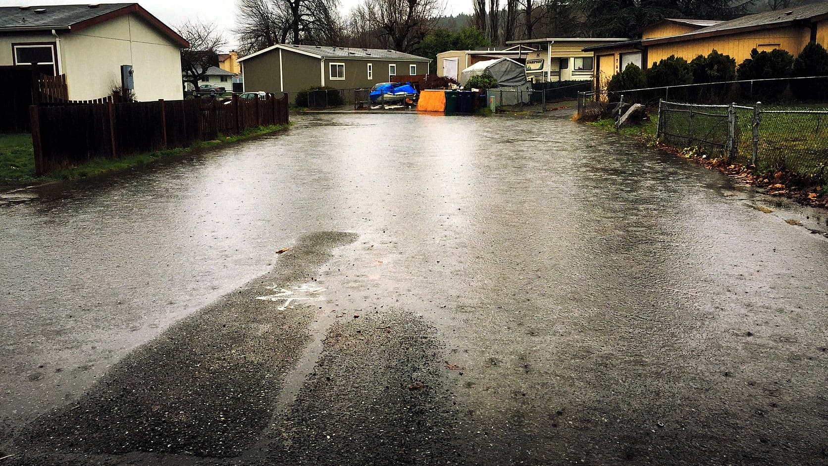
Enumclaw flooding and the White River: King County's four flood phases (4,000 to 8,000 cfs), the gauge that sets them, SR 410 and who to call.
King County rates White River flooding in four phases, and as of October 2026 its flood warning page puts them at 4,000, 5,000, 6,000 and 8,000 cubic feet per second (cfs, a measure of how much water passes a point each second). Phase 1 means county staff are on alert. Phase 4, at 8,000 cfs, is where the county says flooding will occur on the river side of the temporary barriers in Pacific and Auburn and warns that floodwater may overtop Highway 410 near Greenwater. The numbers belong to the county, so check its page for the current ones.
The odd part is what sets the phase. King County's flood warning site says the flood phase for the White River "is determined by Mud Mountain Dam discharge," which is the flow leaving the dam, not the flow rising behind it. Yet the Phase 4 description reaches upstream of the dam to a state highway, where there is no dam to adjust.
How do I check whether the White River is flooding near Enumclaw?
Use King County's Flood Warning System, a website and app that covers seven rivers and Issaquah Creek and, by the county's account, pulls data from the U.S. Geological Survey, the National Weather Service and the Northwest River Forecast Center about every 10 minutes. Its White River page shows the gauges along the river and the phase table. The county's watershed page also lists a Greenwater River gage at Greenwater.
The phase itself is read off a single gauge, the dam's discharge. The county says the source data's timing varies, so treat a reading as a recent measurement and not a live camera.
What are King County's four flood phases on the White River?
The county's table, as read from its White River page, runs like this. Phase 0 means no flooding is typically expected. At Phase 1, 4,000 cfs, "King County staff are on alert and preparing for a possible flood event." At Phase 2, 5,000 cfs, flooding may occur in Pacific near Government Canal and in Pacific City Park, and riverward of the temporary flood barriers in Roegner Park in Auburn, with high water possible along parts of the barriers themselves.
Phase 3 is 6,000 cfs. Flooding may occur on the river side of the temporary barriers in both cities, river levels will likely be high along the barriers, and the county says water may overtop at Government Canal and Butte Avenue as well as in Pacific City Park. Phase 4, 8,000 cfs, adds the Red Creek area, where residents "may experience dangerously high velocities, debris flows, and residential flooding," and the Greenwater stretch of Highway 410. "Riverward" in the county's wording means on the river side of a barrier.
Why does a dam decide the phase?
The county's table is keyed to the flow the Army Corps of Engineers releases from the dam, which the Corps runs. The size of the dam, how it holds back a storm and what it did in 1996 and December 2025 are covered in the Mud Mountain Dam guide, and the sediment that makes the river shallower near Pacific is in the glacial flour story. The county's own watershed page makes the same point, saying sediment buildup makes the channel shallower and so more likely to flood.
Does Highway 410 close when the White River floods?
WSDOT has closed it for floodwater, and at Phase 4 the county warns that floodwater may overtop it. The county's line is that floodwater "may overtop SR 410 upstream of Mud Mountain Dam near Greenwater." What happened in December 2025 shows how that plays out, with one caution: the Washington State Department of Transportation's account says floodwater covered the road and does not name the White River as the source.
By WSDOT's account, maintenance crews closed SR 410 on Wednesday, December 10, 2025, between Enumclaw and Greenwater, from milepost 25 to milepost 43. The eastbound lane eroded badly near milepost 26. KOMO reported the closure as starting Thursday, December 11, so the start date differs between the two. On Tuesday, December 16, the road reopened to one lane over a temporary gravel bypass on the westbound shoulder, with a signal near Farman Street North at milepost 25 alternating traffic, KOMO reported, and access limited to essential movement only, in WSDOT's words as KOMO reported them. WSDOT says repairs under an emergency contract began Monday, December 22 and finished Tuesday, December 23. This site's guide to the one-lane stretch past the washout covers driving it.
Does the White River flood Enumclaw itself?
The county's phase descriptions name no place inside the city of Enumclaw. They name Pacific, Auburn, the Red Creek area and the highway near Greenwater. The county's watershed page describes the river as flowing "between the cities of Enumclaw and Buckley" on its way to the Muckleshoot Indian Reservation and then Auburn, Algona and Pacific, so the town sits near the river without appearing in the table.
That is a statement about what the county's table says, not a flood map of the city. The county also lists the Greenwater River as having two revetments, structures that protect a riverbank. Whether a particular address floods is a question for the county's flood maps and the city, and this article has not checked either.
What happened in Pacific in December 2025?
On Tuesday, December 16, 2025, shortly after midnight, a flood barrier in Pacific failed. King County's Field Notes blog, published December 22, says flood patrol members Josh Kubo and Craig Garric were inspecting the barrier when seepage turned into a breach. They reported it to the county's Flood Warning Center and went door to door, and the account says they helped the last two households leave. Jessy Hardy at the center coordinated with the county's Office of Emergency Management. The county's own Field Notes account does not give a count of people evacuated, and neither does this article.
The county calls the December 2025 atmospheric river among the strongest and longest lasting storms since 1959. The barriers in the phase table are temporary ones, and the county's watershed page describes barrier replacement and other repairs along 3rd Avenue Southeast in Pacific, planned to continue through summer and fall 2026.
When is White River flood season?
The county's watershed page says "Most major White River floods occur from November through February." That is the county's description of when the big ones tend to come, not a guarantee, so check the phase page whenever a storm is forecast, whatever the month.
Who do I call, and how do I get alerts?
The Flood Warning Information Center takes calls at 206-296-8200, or toll free at 800-945-9263, around the clock, and live representatives answer during flood events, according to the county's Flood Warning System page. Interpreters are available on request. The county's instruction for an emergency is to call 911.
The same page says people can get flood alerts by email, text message or phone call, and choose the rivers and phases they care about. Email and text alerts come from msg@mail1.alertsense.com and phone messages from 206-296-8200, so those are the senders to expect. The county's general emergency alert service, ALERT King County, is covered in this site's power outage guide. For sandbags, the county's watershed page lists a self-service site open around the clock at 130 3rd Avenue SE in Pacific, across from the police station, while its sandbag page lists the City of Pacific site at 224 Countyline Road SW, also open around the clock, as of October 2026. Both limit you to 25 sandbags per vehicle, and you bring your own shovel; call 206-296-8200 to confirm which site is stocked.
Before you go
Flooding is not the only hazard this side of Mount Rainier; the lahar zone guide covers the volcanic mudflow zone.
Before driving east in a storm, check three things: the phase and the dam's discharge on the county's White River page, the road's status with WSDOT, and the Greenwater gage. The county sets the thresholds and can revise its table, so read the numbers off its page and not off this one. The county's phase numbers describe the lower river and the Greenwater stretch of the highway. They are not a forecast for any single address.
Story label: Original Story or Guide
Originally published: