

Feature
Mount Rainier viewpoints near Enumclaw, nearest first
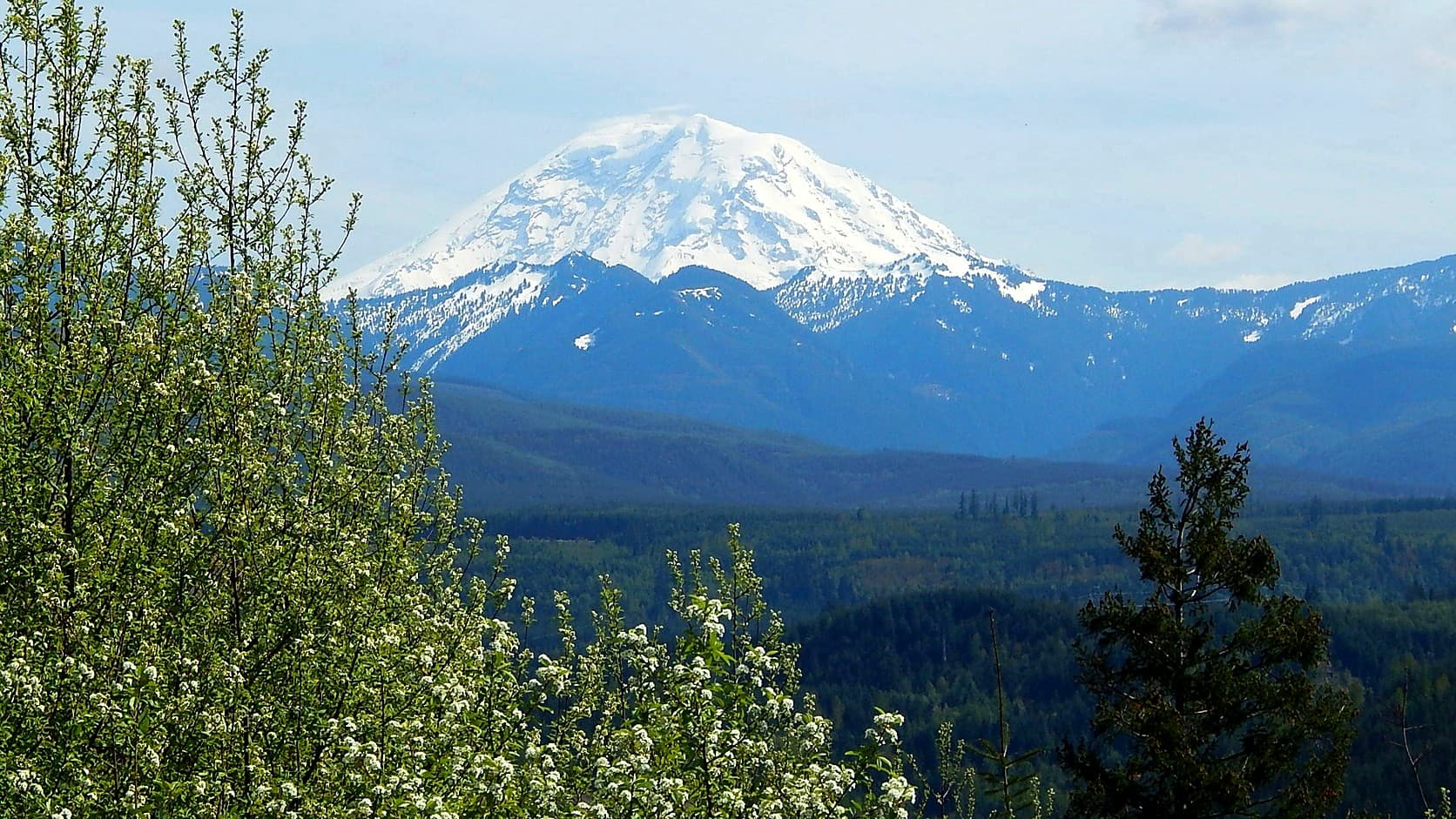
Mount Rainier viewpoints near Enumclaw, nearest first: Mount Peak, Orting, Lake Tapps, Crystal, Tipsoo Lake, Sunrise and Paradise, with fees and closures.
The nearest place to see Mount Rainier from Enumclaw is Enumclaw itself: the summit stands about 27 miles south-southeast of City Hall in a straight line, in plain view over the plateau's fields on a clear day. The nearest viewpoint in this guide is Mount Peak, in King County's Pinnacle Peak Park about 3 road miles from City Hall, with no fee or pass, and reachable since October 9, 2026 by its south trail only. Farther out, nearest first, come Orting, North Lake Tapps Park, Crystal Mountain's gondola, Tipsoo Lake, Sunrise and Paradise. As of October 2026, Sunrise is closed to private vehicles for the rest of the season, Tipsoo Lake is cut off by car when the state closes Chinook Pass, and Paradise is open by day all winter whenever the park opens its gate.
Seattle's parks department describes the view from Kerry Park, on Queen Anne, as Elliott Bay and downtown "with an occasional backdrop of Mount Rainier." That backdrop is about 61 miles from the park in a straight line, measured to the U.S. Geological Survey's summit coordinates. From Enumclaw City Hall it is about 27. The mountain Seattle calls occasional is less than half as far from here.
The list runs nearest first by approximate road miles from City Hall, 1339 Griffin Avenue, measured on October 15, 2026 with OSRM, a public routing engine that knows nothing of seasonal gates. The high roads are closing: the Park Service's road status page schedules Paradise Valley Road to close October 19, 2026, and Stevens Canyon Road and the White River Road October 26, all subject to change.
Can you see Mount Rainier from Enumclaw?
You can on a clear day, from open ground in and around town, and it costs nothing. The face you see is the north side: King County's page for Pinnacle Peak Park lists "views of the north side of Mt Rainier and White River valley" among the rewards at the top of Mount Peak. That face holds the Willis Wall and Liberty Ridge, explained in our piece on the side of Rainier Enumclaw looks at.
The widest views on the plateau cross working farms, and the fields are private. Look from public ground, a park, a sidewalk or a legal parking space, and do not stop in a traffic lane on SR 410, SR 164 or a farm road for the picture.
1. Mount Peak (Pinnacle Peak), about 3 miles from Enumclaw
The 1,800-foot cone King County calls Pinnacle Peak and Enumclaw calls Mount Peak sits just southeast of town. Its steep Cal Magnusson Trail, a mile and 1,000 feet of climbing up the north side, has been closed since October 9, 2026. Part of the hillside is unstable, the county said in a release the Courier-Herald reported, and the trail stays shut until geotechnical experts finish an assessment; the Washington Trails Association's notice of October 13 gave no reopening date. The summit is still open by the south trail, a gravel road at a gentler grade that the county also credits with mountain views, from the parking lot at SE Mud Mountain Road and SE 481st Street, about 3.3 road miles from City Hall.
Under King County Code the park is open from half an hour before sunrise to half an hour after sunset. The county lists no fee or pass, and the trails association lists dogs as allowed on a leash. King County has SE Mud Mountain Road closed between SR 410 and 248th Avenue SE for a bridge replacement through October 30, 2026, a stretch west of the trailhead.
Do not count on the lookout tower for the mountain. The steel tower flown up in pieces in 2021 stands among trees, and in June 2022 the Courier-Herald reported a county proposal to cut 50 of them and prune five, mostly to open a view south to Rainier. The county said then that nothing was decided, and no later decision turned up for this guide. A hiker's report to the trails association in May 2024 found little view from the tower and a glimpse of Rainier through the trees a short way down the south trail.
2. Orting and the Foothills Trail, about 16 miles
Pierce County's Foothills Trail page names the stretch that leaves Orting up the Carbon River, past farms and woods, as one of the most scenic for its "unobstructed views of nearby Mt. Rainier." The Orting trailhead is in Orting City Park, off the main street downtown, about 16 road miles from City Hall by way of Buckley, with parking for several cars and a toilet, by the trails association's description.
The trail is paved, has no fee or pass, and is open from half an hour before sunrise to half an hour after sunset under the county's rules, with dogs on leashes no longer than eight feet. The county expects to start replacing the Ski Park Bridge on this stretch in late 2026 and to route trail users along South Prairie Carbon River Road East rather than close the trail. The Foothills Trail guide has every trailhead from Enumclaw to Puyallup.
3. North Lake Tapps Park, about 16 miles
Pierce County's park on the north shore of Lake Tapps, at 2022 198th Avenue East in Bonney Lake, looks south across the reservoir to the mountain, and the county lists a peninsula walking path that "ends at a Mt. Rainier viewpoint" among its amenities. From October through March the park is open from 7 a.m. to 3:30 p.m., with no cars admitted after 3, so a winter visit ends before sunset; from April through September the hours are 6 a.m. to 8 p.m. It closes on Thanksgiving, Christmas Day and New Year's Day.
The county collects its parking fee only from May through September: $7 for verified residents and $15 for most other drivers in 2026, paid by phone. Expect a lower lake in colder months: its owner, the Cascade Water Alliance, starts the active drawdown November 1 and aims for summer level by April 15; the county says it is usually full by late May.
4. Crystal Mountain's gondola, about 40 miles
Crystal Mountain Resort's Mt. Rainier Gondola rises from the base area, about 40 road miles from City Hall by SR 410, to the Summit House restaurant in about 12 minutes, and the resort sells the ride on its view of Rainier. Its summer schedule for sightseers in 2026 ran from May 22 to September 20. In winter the gondola is a ski lift, included in lift tickets and season passes, and the resort has set Friday, November 27, 2026 for opening day, pending conditions. Its ticket terms mention a winter season for scenic rides, but by October 15, 2026 it had posted no winter schedule or price for sightseers.
A scenic ticket is good for one date and is not refunded or exchanged for rain, wind or cloud, so check the forecast first. Children 4 and under ride free with a paying adult, and dogs ride only in summer. The resort's parking page on October 15, 2026 gave the 2025 to 2026 rules: reservations before noon on winter weekends and holidays, free within seven days with lift access, $10 without.
5. Tipsoo Lake below Chinook Pass, about 45 miles
Tipsoo Lake sits just off SR 410 inside the national park, half a mile west of Chinook Pass. The Park Service describes a half-mile loop around it and says that on clear, calm days the surface can reflect Mount Rainier. The park's 2026 entrance fee applies: $30 per private vehicle for seven days, $55 for the park's annual pass, or an America the Beautiful pass, bought online or at a staffed entrance such as White River, by card only. Pets are not allowed on park trails.
Cars can reach the lake only until the state closes SR 410 over the pass for the winter, on no fixed date. On October 15, 2026 the state's transportation department listed no restrictions, and the park's road page estimated a closing in mid to late November, weather dependent; the state's table shows the pass closing on October 24 in 2025. The guide to when Chinook Pass closes has the dates back to 1935.
6. Sunrise, about 54 miles
At 6,400 feet, Sunrise is the highest point in the park a vehicle can reach, the Park Service says, with views of the mountain and the Emmons Glacier. For the rest of the 2026 season its road is closed to private vehicles because of the Grand Park 2 and Wonderland Complex fires, by the park's alerts of October 13, and open only to walkers and cyclists, with no drinking water at the top. The White River Road to the campground, 12 miles below Sunrise, is due for its normal winter closing on October 26, 2026, weather permitting.
In a normal year cars can drive the Sunrise Road from late June or early July until late September or early October. Entry is $30 a vehicle for seven days, or $15 for each walker or cyclist 16 or older.
7. Paradise, about 80 miles from Enumclaw in winter
Paradise, at 5,400 feet on the mountain's south side, is the only national park viewpoint on this list you can drive to in winter. Until Stevens Canyon Road's scheduled closing on October 26, 2026, the drive over Cayuse Pass is about 74 miles; after that the only way in by car is the Nisqually Entrance near Ashford, about 80 miles from City Hall by way of Buckley, Orting, Eatonville and Elbe.
Once nightly closures start, typically in late October or early November, the gate above Longmire usually opens at 9 a.m., closes to uphill traffic at 4 p.m. and locks at 5, and the park can keep it shut for weather or avalanche danger, and in some winters on set weekdays; on October 14, 2026 the closures had not begun. Every vehicle must carry tire chains from November 1 to May 1, and entry is $30 a vehicle for seven days. Until the closures begin in 2026, the Jackson Visitor Center is open Friday through Monday, 10 a.m. to 3:30 p.m. The guide to Mount Rainier in winter covers the gate, the chains and what stays open.
Reflection Lakes, where the park promises a possible glimpse of the mountain's reflection, and the Inspiration Point pullout are on Stevens Canyon Road and close with it, as does the trailhead for the park's own Pinnacle Peak, a 2.6-mile hike into the Tatoosh Range that has nothing to do with Enumclaw's. One overnight closure to know about: SR 706 outside the Nisqually Entrance is scheduled to close from 9 p.m. Friday, October 16, 2026 to 6 a.m. Saturday for culvert work, with no access to the entrance in those hours.
Is the mountain out? What to check before you go
Look before you drive. The Park Service's webcams page carries a Paradise camera captioned "Is the mountain out? What is the weather like at Paradise?" along with cameras at Longmire and around the Jackson Visitor Center; its two Sunrise cameras are down for the winter until summer 2027, the page says. From town, a privately run stream that points at Rainier from Enumclaw answers the same question when it is broadcasting.
Then check the road. For Tipsoo Lake and Sunrise, read the park's Alerts and road page and WSDOT's Chinook Pass report; for Paradise in winter, the park asks visitors to read its Alerts after 4 p.m. the day before. For Mount Peak, check King County's road alerts and the trails association's page; for Orting, Pierce County's trail updates; for Crystal, the resort's mountain report. Mount Peak and the Foothills Trail close half an hour after sunset, and North Lake Tapps Park at 3:30 p.m. from October through March.
Story label: Original Story or Guide
Originally published: