

Feature
Atmospheric rivers in Washington, rated from AR 1 to AR 5
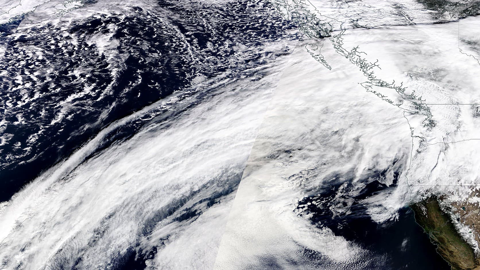
An atmospheric river in Washington is rated AR 1 to AR 5 by CW3E. What the ratings mean, how often strong ones hit and what December 2025 did near Enumclaw.
In Washington, an atmospheric river is a long, narrow band of water vapor, and along the West Coast these bands are the source of most of the heaviest rain and floods, according to the Center for Western Weather and Water Extremes (CW3E) at Scripps Institution of Oceanography. CW3E rates them on an AR scale, from AR 1, weak and primarily beneficial, to AR 5, exceptional and primarily hazardous. CW3E's summary of the December 2025 storm rated it AR 4 on the Washington and Oregon coast and AR 3 over the western Cascade foothills; the same storm closed Highway 410 between Enumclaw and Greenwater.
NOAA says the average atmospheric river carries about as much water vapor as the average flow at the mouth of the Mississippi River, and the strongest can carry up to 15 times that. The Washington State Climate Office reported that the highest precipitation total of any station in the state during the December 2025 storm, 21.80 inches, came from Lynn Lake, a 3,900-foot snow-and-weather station about 10 miles east of Enumclaw.
What is an atmospheric river?
An atmospheric river is a long, narrow stream of water vapor carried by strong winds through the lower atmosphere. NOAA describes it as one of the "relatively long, narrow regions in the atmosphere" that carry most of the water vapor outside the tropics, and the river comparison is arithmetic, not poetry: scientists divide the vapor's mass by the density of liquid water, which gives a volume they can set beside a real river's flow. Most atmospheric rivers are weak, NOAA adds, and bring rain or snow that water supplies depend on; NOAA Research says about 30 to 50 percent of a year's precipitation in the West Coast states arrives in just a few of them.
What do AR 1 to AR 5 mean?
AR is short for atmospheric river, and the 1 to 5 rating CW3E introduced in a February 2019 paper weighs how much water vapor a storm carries at its peak and how long it lasts. Peak transport, measured in kilograms of vapor per meter of width per second, falls into five levels that start at 250 and step up to 1,250 and above. A storm that keeps transport above 250 for 24 to 48 hours takes its level's number, 1 through 5; one that lasts under 24 hours drops a category, and one that lasts over 48 hours gains one, with AR 5 as the ceiling. A storm peaking between 750 and 1,000 is therefore an AR 3 after 24 to 48 hours and an AR 4 after longer.
CW3E's names for the levels run weak, moderate, strong, extreme and exceptional, so an AR 4 is an extreme one. CW3E calls AR 1 primarily beneficial, AR 3 a balance of beneficial and hazardous and AR 5 primarily hazardous. The rating is CW3E's, not a National Weather Service warning, and CW3E says it reflects conditions across a region roughly 50 kilometers (about 31 miles) in size and is not meant to show the details of one town, so the AR 3 over the foothills is not a rating for Enumclaw.
How often does Washington get an extreme atmospheric river?
On the Washington coast, peak vapor transport reaches 1,000, the figure that starts CW3E's extreme level, about once every two years. That comes from the 2019 scale paper, which draws on an analysis of weather data from 1948 to 2015, and CW3E's announcement summed it up as Washington getting extreme atmospheric rivers about every two years, against about once a year on the Oregon coast and every 10 years in Los Angeles. It is a long-run average for the coast and says nothing about when the next one will come; the same paper finds AR 4 and AR 5 events mostly on the coast, since storms lose water to the mountains as they move inland. NOAA and Army Corps of Engineers researchers wrote in 2011 that western Washington's heavy-precipitation and flood season runs from late October to mid-March, with the biggest river flows most often from November to January.
Is an atmospheric river the same as a Pineapple Express?
A Pineapple Express is one kind of atmospheric river, not another name for all of them. NOAA describes it as a strong atmospheric river that can bring moisture from the tropics near Hawaii to the West Coast, and the 2019 scale paper notes that some atmospheric rivers pull in tropical vapor but that this is not a trait of every one.
Why do atmospheric rivers flood the foothills around Enumclaw?
Because a warm atmospheric river raises the snow level, the elevation above which precipitation falls as snow, rain lands on slopes that would otherwise hold the water as snowpack. The Washington State Climate Office said that in December 2025 "very high snow levels due to warm conditions meant much of this mountain precipitation fell as rainfall rather than snow," and a CW3E radar in the Green-Duwamish watershed put the snow level near 9,000 feet at the storm's second surge. Earlier rain had already saturated the soil, the office added, and CW3E counted about 96 hours of atmospheric river conditions in some places.
A 2011 study by NOAA and Army Corps researchers, prompted by storm damage at Howard Hanson Dam, found the same pattern at four western Washington rivers, the Green among them: 46 of 48 yearly peak flows from 1998 to 2009 came with an atmospheric river, and during each river's ten biggest peaks from 1980 to 2009 the melting level, where falling snow turns to rain, averaged about 1.9 kilometers (roughly 6,200 feet), nearly a kilometer above normal.
Our Green River headworks story covers that dam and its January 2009 storm scare, and our look at snow versus rain on the plateau explains how a few hundred feet decide whether Enumclaw gets rain or snow. The Climate Office called December 2025 a preview of the warm, rain-dominant floods it expects more often, though it said it was too early to say how much climate change contributed.
How much rain fell near Enumclaw in December 2025?
NOAA's archive of daily readings from the weather station at Mud Mountain Dam adds up to 9.16 inches of precipitation across four daily readings dated December 9 to 12, 2025 (each covers the 24 hours ending at 8 a.m.), more than the 6.30 inches NOAA's 1991 to 2020 normals list for a whole December. NOAA's records show no long-running station in Enumclaw itself, so the dam's gauge, about five miles southeast of the city center in a straight line, is the stand-in. Its daily records start in 1939, and our Mud Mountain Dam guide covers the dam itself.
Higher up the totals were larger. The Climate Office's top two stations in the state both sit in King County's western Cascades: Lynn Lake, with 21.80 inches, and Skookum Creek, with 19.70 inches.
How does December 2025 compare with November 2006?
November 2006 was bigger by rain volume across western Washington: the Climate Office's ranking since 1981 puts that storm first for both one-day and four-day totals, with December 2025 fifth for four days and seventh for one day. The office added that the wettest day of December 2025 matched a volume that falls on western Washington about once every five years.
At Mount Rainier, the park says a steady rain began around 1 p.m. on Sunday, November 5, 2006, and lasted to mid-afternoon on Tuesday, November 7, with nearly 18 inches recorded at Paradise, and that the White River overflowed and flooded Highway 410 for several miles. The park's six-month closure is in our Carbon River Road story. The National Weather Service's Seattle office calls the storm an atmospheric river event that imported subtropical moisture, and counts 15 rivers in western Washington at all-time flood crests. Forecasters saw it coming: their discussion on the evening of November 4 said "This does not look like a run-of-the-mill flood."
Where can you see an atmospheric river forecast?
CW3E posts a seven-day AR Scale forecast with coastal, foothills, inland and interior West views, and it offers email or text alerts for Washington. As of October 2026 the sign-up form asks for a name and an email address, plus a phone number and carrier for texts, mentions no fee, and lets you choose every rating, AR 1 to AR 5, or only AR 3 to AR 5. The alerts draw on NOAA's or the European Centre's ensemble forecast runs, which CW3E refreshes about every six or 12 hours. CW3E calls its forecast products experimental and says they are provided as is for research purposes only. They forecast a rating, and the warnings come from the Weather Service. NOAA's Physical Sciences Laboratory runs an Atmospheric River Portal with satellite water vapor images and other current conditions, and NOAA says Weather Service forecasters can warn of atmospheric river flooding as many as five to seven days ahead. The Weather Service's Seattle office posts those watches and warnings, along with its forecast discussion and river forecasts.
Before you go
An AR rating says how much water is coming, not what one creek will do: the 2019 paper warns that a category's effects vary with terrain, ground conditions and where the rain turns to snow. On the day of a storm, check the Weather Service for watches and warnings, CW3E for the rating, and King County's White River phase and the road status, which our White River flood guide walks through along with the Highway 410 closure of December 2025. For who to call when the lights go out, see the power outage guide. Ratings and forecasts change with every model run, so read the current numbers off the agencies' own pages.
Story label: Original Story or Guide
Originally published: