

Feature
Where to see bald eagles in Washington, the Skagit River
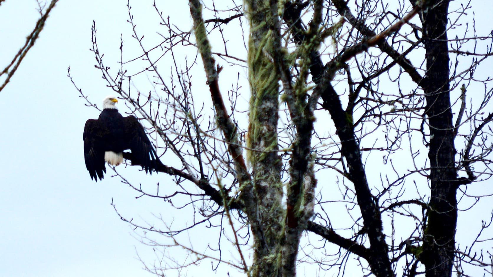
Where to see bald eagles in Washington: the Skagit from Rockport to Marblemount, late November to January. Viewpoints, center hours, river rules, the drive.
The Skagit River between Rockport and Marblemount, about 128 miles north of Enumclaw by the shortest road, is where Washington's wintering bald eagles gather in the largest numbers, and the watching is free from the roadside. The Concrete Chamber of Commerce puts the season at late November to late January, with the most birds from Christmas to the second week of January, and as of October 2026 the volunteer-run Skagit River Bald Eagle Interpretive Center in Rockport opens on weekends from early December to mid-February, 10 a.m. to 4 p.m., with free guided walks at 11 and 1:30. Neither main viewpoint, Howard Miller Steelhead Park or the milepost 100 pullout on State Route 20, needs a pass, and the drive crosses no mountain pass.
The superlatives on other pages are older than they look. On January 3, 2007, a Nature Conservancy counter tallied 580 eagles on an 11.5-mile stretch of the river, the Seattle Times reported, and no later count found for this article has beaten it. The center's own raft counts from Rockport to Marblemount peaked at 117 in the week of December 22, 2017, and at 42 in December 2019, the last season it published; the Forest Service volunteers' weekend tallies at three roadside stations in 2025-26, which they warn may count a returning bird twice, peaked at 157 on January 10 and 11, 2026. Its 2022-23 season report says the rest plainly: "The number of bald eagles has declined noticeably during the past few years. This is attributed to a decline in the fall chum salmon run which the eagles depend on." The eagles still come. There are fewer of them, and they follow the salmon, not the calendar.
When do the bald eagles arrive on the Skagit River?
Late November, by the chamber's page dated January 29, 2026, with the crowd building from Christmas into the second week of January, which the chamber times at roughly a fortnight behind the peak of the salmon spawn. The Washington Department of Fish and Wildlife says eagles that nest in Canada and Alaska winter on rivers with spawned-out salmon, chum above all; the Forest Service's highway page, updated September 19, 2026, has them arriving in late fall and staying through January.
The center's advice beats any date. Go between dawn and 11 a.m., and pick a gray day: its viewing-tips page rates overcast weather the best for finding and photographing eagles here, because on sunny days the birds leave the river to soar over the valley. From mid-December to late January, the center's count page says, you might see as many as 100 eagles from Highway 20. That is its ceiling, not its promise.
Where to stand between Rockport and Marblemount
Howard Miller Steelhead Park, the Skagit County park where the Sauk meets the Skagit at Rockport, is the place to start, and the SR 530 bridge beside it is the place to look from. The center's viewing-sites page says the Forest Service's Eagle Watcher volunteers set up in the park near the bridge, and that "The best vantage point is from the bridge, looking upstream to gravel bars, and the trees along the river." The park has flush toilets and a boat ramp.
Three miles upriver, the milepost 100 rest area at Sutter Creek on SR 20 puts the river beside the parking lot, looking across to the feeding bars on the south bank. The Forest Service's rangers and volunteers announced weekend scope stations at both sites for December and January of the 2024-25 winter, and the volunteers' weekend-count page shows the park, milepost 100 and the Marblemount boat launch staffed again from December 20, 2025 to January 25, 2026, with some weekends short of volunteers; nothing for 2026-27 had been posted by October 14, 2026, so treat the scope as a bonus. Between the two, the SR 20 pullouts work from the car, which the chamber says to use as a blind.
Is the Skagit River Bald Eagle Interpretive Center open, and what does it cost?
On winter weekends, for donations rather than a fee. The center opened in 1997 inside the park and is run by the Skagit River Bald Eagle Awareness Team, a nonprofit. Posted hours are Saturdays and Sundays, 10 a.m. to 4 p.m., with walks at 11 a.m. and 1:30 p.m. that run about 90 minutes on the park's mostly flat Wetland Wildlife Trail, free with donations welcome and no dogs.
Each season's dates are posted on the center's site. The 2025-26 season ran from Saturday, December 6, 2025 to Sunday, February 15, 2026, with extra days from December 27 to January 1. As of October 14, 2026 the 2026-27 dates were not posted. The phone is 360-853-7626.
The Skagit Eagle Festival, the January weekend program in Concrete, Rockport and Marblemount that Seattle Refined described in January 2019, has disappeared from the Concrete chamber's eagle page, which the chamber has moved off the festival's old web address (that address now redirects to it) and updated on January 29, 2026 without a word about it. No schedule for a 2026 or 2027 edition turned up. The Skagit Valley Herald reported in January 2021 that the pandemic had forced the festival's cancellation for the first time in its history, and the Concrete Herald, in a later piece on the eagles, quoted the chamber's president, Valerie Stafford, saying the volunteers and contractors who ran it had stepped away. The chamber's page does still list drift-boat tours by reservation.
What are the rules on the river?
The morning belongs to the eagles, by request and by law. The Forest Service asks everyone to keep boats off the river between the Marblemount and Rockport bridges from 5 a.m. to 11 a.m. daily from December 26 to February 28, a voluntary closure on its Marblemount Boat Launch page, updated July 6, 2026, which also asks boaters not to beach between the bridges. The closure dates from 1996, by WDFW's 1997 release. The chamber's rules for people on foot match: keep noise low and movements slow, "Stay away from the river's edge and gravel bars where eagles are feeding, especially between 5 and 11 a.m.," and remember that most of the frontage is private.
Behind the courtesy sits the Bald and Golden Eagle Protection Act, whose regulations define "take" to include "disturb," meaning agitating or bothering an eagle enough to cause, or be likely to cause, injury, or a drop in its productivity or the abandonment of its nest through substantial interference with its feeding, breeding or sheltering, and whose first-offense penalty is a fine of up to $5,000, up to a year in jail, or both. Dogs are allowed in the park on an 8-foot leash, by the county's rules, and not on the walks.
How far is the Skagit from Enumclaw, and which way?
About 128 miles and three hours, with no mountain pass. A routing engine's shortest line runs up SR 169 to Renton, I-405 and I-5 to Arlington, then SR 530 through Darrington to Rockport. The route the center gives, I-5 to exit 230 at Burlington and SR 20 east through Concrete, is about 137 miles and a few minutes longer. Both stay low, which makes this the easy winter wildlife trip: the Oak Creek elk feeding station is three and a half hours away by the same engine and sits beyond the Cascades, and the winter road to Yakima means chains behind the seat. The eagle run needs none of that.
SR 20 past Marblemount is another matter. WSDOT closed the North Cascades Highway on December 4, 2025, between the Ross Dam trailhead at milepost 134 and the Silver Star gate at milepost 171, and moves the west gate down to Newhalem, milepost 120, as snow requires, by its December 3, 2025 release. The eagle reach ends at Marblemount, about 14 miles below that gate by the routing engine, so the closure never touches it.
Howard Miller Steelhead Park is open for camping and day use all year, by the county's page, with tent sites at $30 a night and a cabin at $90 for a single night under the fee schedule that took effect October 1, 2025, which the Skagit Valley Herald reported the county commissioners approved on August 25, 2025, and which makes day use free for visitors who stay with their vehicle, lists a $5 parking fee for anyone who does not, and says non-campers may not park a vehicle and leave the park. Reservations are taken online through the county's booking site or by phone, 360-853-8808. The county's address is 52804 Rockport Park Road, the center's 52809; it is one park.
Why the Skagit: a 1975 land deal and a wild river
The river did not become an eagle refuge by accident. In 1975-76 the state Department of Game, WDFW's predecessor, bought land at the Skagit-Sauk confluence with the Nature Conservancy's help to protect winter roosts, by WDFW's page for its boat-only Bald Eagle Wildlife Area Unit of about 600 acres; the Conservancy's Skagit River Bald Eagle Natural Area began in 1975, the Seattle Times reported. In 1978 Congress added the Skagit, Sauk, Suiattle and Cascade rivers to the National Wild and Scenic Rivers System, the Forest Service says, which is why a national forest sets the river's winter rules.
WDFW's page is candid about what came next. The unit once held the fifth-largest winter gathering of bald eagles in the lower 48 states, it says, "but with dramatic improvements in bald eagle populations, the delisting of eagles, and the changes in returns of Chum salmon, this designation has changed." More eagles everywhere, fewer chum here. The Forest Service's wording in July 2026 is "one of the largest concentrations of wintering bald eagles in the continental United States," the claim this article stands behind.
Bald eagles closer to Enumclaw
The center's statewide list of eagle spots, which its page says was compiled from a CBS Seattle story, includes one about 8 miles from Enumclaw. At South Prairie, it says, walk or ride the Foothills Trail east of town and you will likely see bald eagles "perched high in the tall streamside trees." The mechanism is the same: WDFW says wintering eagles concentrate where salmon have spawned and died, chum above all. At home, Boise Creek's chum spawn in November and December by King County's timing, as the Boise Creek salmon guide lays out, and Enumclaw's elk herd is in the fields in the same months. No published count exists for Boise Creek. The Skagit is where the counting has been done, by the Park Service, the Forest Service and the Conservancy together on winter Wednesdays since the 1980s, as of a Park Service page last updated in 2017.
Before you go
Open the center's site for the season's dates and any weather notice, and WSDOT's travel map for SR 530 and SR 20 the morning you leave; the center's count table lost a week to flooding in January 2019. Pack binoculars, rain gear and boots, leave the dog home if you want the walk, and keep to the bridge, the pullouts and the car until 11. Then find a gray morning between Christmas and the second week of January, and count for yourself.
Story label: Original Story or Guide
Originally published: