

Feature
Snoqualmie Tunnel closure dates and what to bring
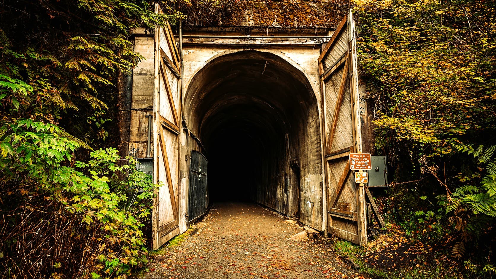
Snoqualmie Tunnel closure dates: State Parks closes it November 1, 2026 and gives May 1 or April 30 to reopen, weather permitting. Passes and what to bring.
As of October 2026, Washington State Parks closes the 2.3-mile Snoqualmie Tunnel, on the Palouse to Cascades State Park Trail, from November 1, 2026. That is a Sunday, so Saturday, October 31 is the last day its dates leave open. State Parks gives the reopening as May 1 on its trail page and April 30 on its Winter Schedule page, and says on both that the date depends on the weather. The east entrance is at Hyak, I-90 exit 54, about 56 road miles from Enumclaw by a routing engine's estimate.
The state does not word the closing the same way twice. The West section's page says the tunnel "tentatively closes at the end of October and reopens in May," the Central section's page says near the end of October, and the park brochure marks the tunnel open May 1 to October 31. Meanwhile a notice on the Central page, posted May 8, 2026, reads "The Snoqualmie Tunnel is open for the 2026 season." It is set to expire on November 1, 2026, the day the tunnel closes.
When does the Snoqualmie Tunnel close and reopen?
It closes November 1 and reopens in early May if the weather allows. State Parks' trail page says the tunnel is closed from November 1 to May 1, and its Winter Schedule page says November 1 to April 30. Read literally, the first leaves May 1 closed and the second leaves it open, a one-day gap the agency does not explain. Both add the same condition: the reopening date depends on the weather. The Washington Trails Association's hike page for the tunnel says it is closed November 1st through May 1st.
None of the State Parks pages read for this article says who decides the reopening day or when the notice goes up. The one record of a past opening is the Central page's notice from 2026, posted May 8 and silent on which day the tunnel opened. The rule that lasts from year to year is therefore simple: the state sets the dates, the snow moves them, and the place to look is the park's alerts page. The West section's page also calls the closing date tentative, so check before driving.
Why does the tunnel close for the winter?
State Parks does not say. Its pages give the dates and the weather condition and stop there. Wikipedia's article on the tunnel says it is usually closed between November 1 and early May because ice forms inside, but it cites nothing for that sentence, so treat it as a reasonable explanation and not a ruling. What the state does say about conditions is in its brochure, which calls the tunnel "dark, cold and damp." The Washington Trails Association adds that water drips from the ceiling in places and that the tunnel stays chilly even on the hottest summer day, which makes a closed season for ice easy to believe.
How do you get to the Snoqualmie Tunnel from Enumclaw?
Take I-90 east over Snoqualmie Pass to exit 54, Hyak and Gold Creek, about 56 road miles from Enumclaw City Hall by the OpenStreetMap-based OSRM routing engine, an estimate that ignores traffic and snow. The park's brochure says to go south off the freeway to the stop sign, turn left onto Route 906, which runs beside the freeway, and follow the signs to the tunnel. The trails association's directions add that the route is poorly marked, that the turn for the lot comes 0.5 miles along, and that the lot has an automated pay station and restrooms.
From the lot the trails association describes a gravel path to a metal gate about a tenth of a mile along, which it says is easy to walk around, and the tunnel mouth at about a third of a mile. Its entry lists the round trip at 5.3 miles, rated easy to moderate, and its description walks to the far end and back. That is the trails association's figure, not a State Parks one.
The west entrance is harder to pin down. The brochure says the Homestead Valley Trailhead, off I-90 exit 38, is the first trailhead west of the tunnel and needs a Discover Pass, but it gives no distance from there to the portal. It also says two Forest Service trails, McClellan Butte from exit 42 and Annette Lake from exit 47, meet the Palouse to Cascades Trail about a mile from their trailheads, with a Northwest Forest Pass required. Measure on State Parks' trail map before planning to walk in from the west.
Do you need a pass for the Snoqualmie Tunnel?
Yes, a Discover Pass, which is $45 for a year or $10 for a day as of October 2026 on State Parks' Discover Pass page, with transaction fees possible. A pass may be shared between two vehicles, but only one can use it at a time. The brochure still prints $30 for the annual pass, so the price has moved since it was written, and the pass page is the one to trust. Our guide to which pass works at which park near Enumclaw sorts out the others.
A different permit takes over in winter. As of October 2026, State Parks' trail page puts the Sno-Park permit season at December 1 to March 31, and the Central section's page says the Hyak Trailhead becomes a Sno-Park from December through March. Prices and the way State Parks words the permit season are in our Sno-Park permit guide. State Parks' pages do not say whether the tunnel's own lot and the Sno-Park are one and the same, so read the signs at the lot.
What should you bring into the Snoqualmie Tunnel?
A jacket with a hood and a light. The brochure says to bring a jacket with hood to keep warm and dry, and a flashlight or headlamp "to see and be seen." The trails association suggests checking that the light works and carrying spare batteries, and its tip for the dark is reflective clothing or a blinking light, because bicyclists are faster than walkers and can come up quickly.
The rules are short. The brochure says inside the tunnel hikers yield to equestrians, and bicyclists yield to hikers and equestrians. State Parks lists the trail as day use only, with dogs on leash, horses allowed and no fires. Motor vehicles are barred except snowmobiles, and those may run only between Stampede Pass Road and Cabin Creek.
What is open near the Snoqualmie Tunnel in winter?
The trail outside the tunnel, with changed hours and a different permit. As of October 2026, State Parks gives 8 a.m. to dusk as the winter hours on its trail page and on the Central section's page, which covers the Hyak side, against 6:30 a.m. to dusk in summer. The West section's page gives 6:30 a.m. to dusk year round. For winter, the trail page lists cross-country skiing, snowmobiling, dog sledding and snowshoeing as possibilities, with the choice left to location and conditions.
For the West section, the Winter Schedule page lists only the tunnel and the backcountry campsites as closing, both from November 1 to April 30, and says the Ponderosa campsite is open all year. The trail's western end at Cedar Falls sits by Rattlesnake Lake, and our guide to Rattlesnake Ledge in winter covers the lake and the trails around it, and notes that the tunnel's closure belongs to a different trail.
Why is there a railroad tunnel under Snoqualmie Pass, and what did it have to do with Enumclaw?
The Milwaukee Road railroad built it in 1914 "to improve the grade over the pass," the brochure says. State Parks calls it "the nation's longest tunnel open to nonmotorized traffic," an agency claim for which the pages read give no source. The last Milwaukee Road train crossed the Cascades in 1980, Washington began acquiring the right of way in 1981, and the first stretch of recreational trail opened in 1984, all by the brochure.
Enumclaw had its own piece of the same railroad. An Enumclaw history site says the Milwaukee Road came to town in 1910 with its own depot. Our guide to the Northern Pacific's main line and the Stampede Tunnel says the Milwaukee Road's Enumclaw spur left the Milwaukee's own line near Cedar Falls, where State Parks says the trail's West section begins, and that the Milwaukee's last train through Maple Valley ran in March 1980. At Stevens Pass the Great Northern replaced its climb with a tunnel in 1929, after the avalanche told in our Wellington guide.
Before you go
Check the Central section's alerts on the State Parks alerts page on the day, because the closing is tentative and the reopening has no fixed date. The Central section's office number is (509) 656-2586, the West section's is (425) 455-7010, and the State Parks Information Center is (360) 902-8844. Carry a Discover Pass, a jacket with a hood and a light with spare batteries. If the tunnel is closed when you arrive, the trail outside it is not, but State Parks' pages warn that parts of the trail can have construction or closures, so look at the alerts before choosing another stretch.
Story label: Original Story or Guide
Originally published: