

Feature
Volcanoes in Washington state, the 7 on the USGS threat list
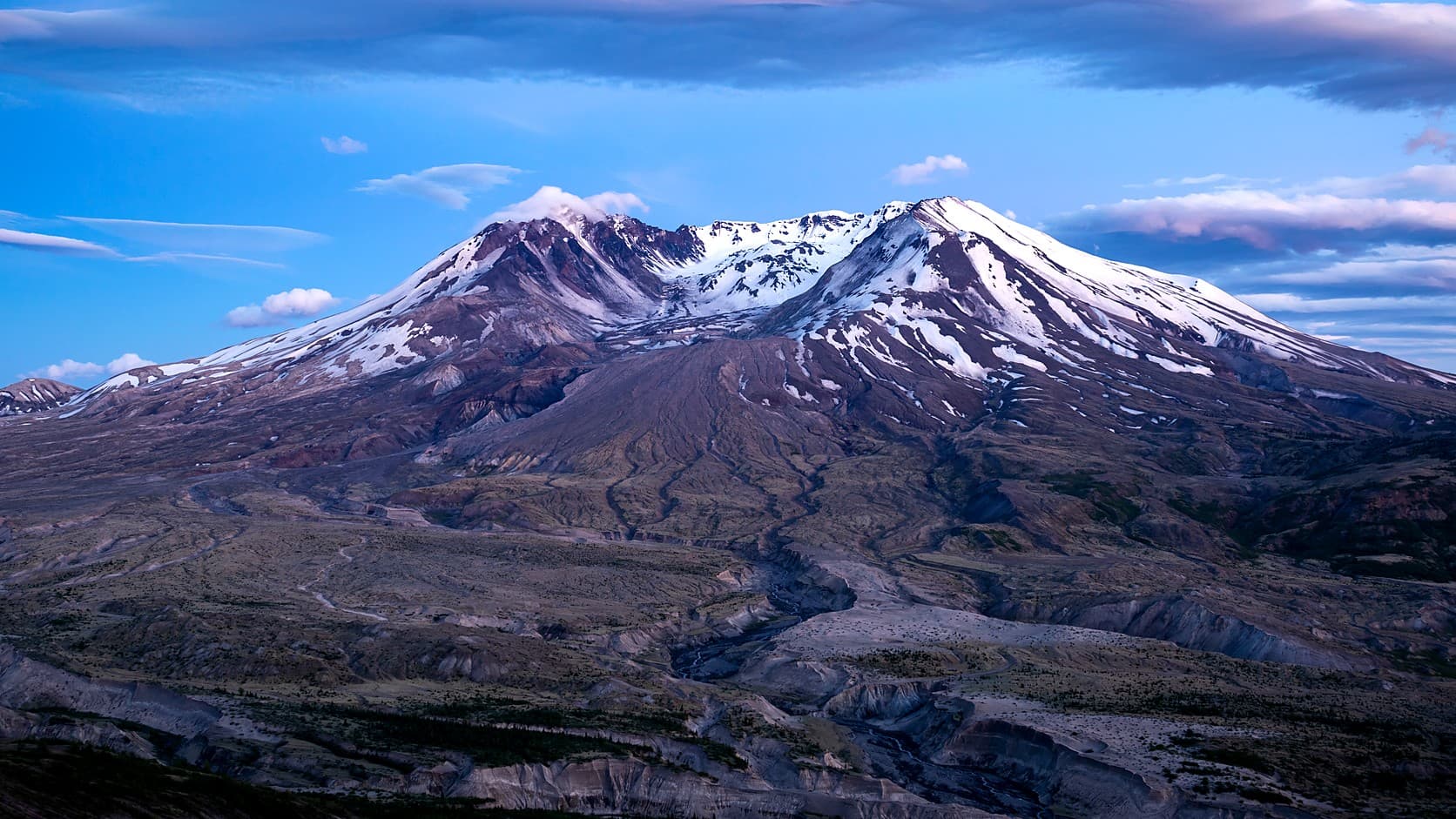
Volcanoes in Washington state: the USGS ranks seven, with St. Helens and Rainier 2nd and 3rd in the nation. Last eruptions, heights and miles from Enumclaw.
Washington has seven volcanoes on the U.S. Geological Survey's national threat list: Mount St. Helens, Mount Rainier, Mount Baker, Glacier Peak and Mount Adams, plus two volcanic fields in the south Cascades, Indian Heaven and West Crater. In the USGS's 2018 threat assessment, the edition its volcano early warning program still cites as of October 2026, St. Helens ranks second in the nation and Rainier third, behind only Kilauea in Hawaii. Rainier is also the closest to Enumclaw, about 27 miles from City Hall in a straight line.
Some official pages say five. The USGS's own page for Glacier Peak calls it "the most remote of the five active volcanoes in Washington State," and the state Department of Natural Resources names the same five stratovolcanoes, the tall cones built up from layers of lava and ash, as the ones rated high or very high threat. The assessment counts volcanoes that have erupted in the Holocene, the roughly 11,700 years since the last ice age, which adds two fields of shield volcanoes, the low, broad kind built by runny lava, and cinder cones, small hills of loose volcanic cinders, that last erupted 8,000 to 9,000 years ago. The same rule leaves out Enumclaw's own volcanic hill: the state's geologic map puts Mount Peak, also called Pinnacle Peak, in a formation of lava and volcanic rubble whose dated rocks run from about 16 million to 25 million years old, as the history of the Mount Peak lookout explains.
Four of the 18 volcanoes the USGS rates very high threat nationwide are in Washington, as many as in Oregon and one fewer than in Alaska. Each volcano's overall score multiplies a hazard score, summed from 15 factors such as how often and how violently it has erupted, by an exposure score summed from nine, such as the people, roads, power lines and air traffic within reach. It measures what an eruption could do, not when one will come; the report calls itself "not a forecast or indication of which volcanoes are most likely to erupt next." The list follows the assessment's order, with heights and last eruptions from each volcano's USGS page, later dates from the Smithsonian Institution's volcano catalog where it has them, and straight-line distances from City Hall.
1. Mount St. Helens, second in the nation
Mount St. Helens scores 235, second only to Kilauea's 263, and its separate aviation score, which rates the danger its explosive eruptions pose to aircraft, is 59, the highest the report gives any volcano in the country. It is the only one of the seven to have erupted in the last hundred years, most famously in 1980 and most recently from 2004 to 2008, and the USGS calls it the most active volcano in the Cascades since the last ice age.
On May 18, 1980, a magnitude 5.1 earthquake at 8:32 a.m. set off what the USGS ranks as the largest debris avalanche ever recorded on Earth; 57 people were killed or are still missing, by the agency's count. The eruption took about 1,300 feet off the top, and it has lost more since: the USGS gives 8,330 feet from a 2009 lidar, or laser, survey, against 8,365 in 1982, and says erosion and collapsing crater walls likely account for the difference. It stands about 70 miles south of City Hall.
Johnston Ridge Observatory, on the ridge where the photograph above was taken, was still cut off as of October 2026, after a landslide on May 14, 2023, destroyed a bridge on State Route 504. WSDOT said on August 6, 2026 that the replacement is scheduled for completion in spring 2027, after which the Forest Service must repair the observatory before it reopens.
2. Mount Rainier, third, and about 27 miles from Enumclaw
Mount Rainier scores 203, third in the country, and the USGS names lahars, the fast slurries of mud, rock and water that pour down river valleys, as its greatest potential hazard. The USGS puts its last magmatic eruption, one that brought up new molten rock, roughly 1,000 years back; the Smithsonian's catalog lists a radiocarbon-dated eruption around 1450, give or take a century.
About 5,600 years ago the top of the mountain collapsed during a period of eruptions, leaving a horseshoe-shaped crater open to the northeast that the USGS says was almost the size of the one St. Helens made in 1980. The debris ran down the White River past the site of Enumclaw as the Osceola Mudflow, and the USGS lists Enumclaw among the towns built wholly or partly on its deposits. The lahar-zone guide covers what the hazard maps show for town, and an essay on living on the Osceola covers the rest.
Its height depends on whom you ask. The USGS gives 14,410 feet. Surveys led by Eric Gilbertson, a Seattle University mechanical engineering professor at the time, found in 2024 that the old ice summit, Columbia Crest, had melted to 14,389.2 feet and that a rock point on the southwest crater rim, at 14,399.6, had become the top; this site's September 2026 report on the new high point used those figures. By the team's account they share an older datum, the sea-level reference surveyors measure from, with the 14,410. On the newer datum in standard use, the team puts the rim at 14,406.2 feet, unchanged within its margin of error when it measured again in August 2026.
3. Mount Baker, 14th in the nation
Mount Baker scores 139, enough for the very high group, and by the USGS's description it is the highest peak in the North Cascades, at 10,781 feet, and the northernmost volcano in the lower 48. It stands about 109 miles north of City Hall.
The USGS lists its most recent eruption as 6,700 years ago, the only eruption of magma known from Sherman Crater; it began with collapses of the volcano's flanks whose debris dammed the Baker River to create Baker Lake. A steam-driven blast from Sherman Crater, just south of the summit, spread a wide fall of recycled crater rock in 1843 and began a run of steam explosions that lasted into the 1880s, by the USGS's account, and the Smithsonian's catalog lists 1880 as Baker's last eruption. In 1975 and 1976 magma pushed up into the volcano without erupting, and the USGS says Sherman Crater has given off more steam ever since.
4. Glacier Peak, 15th in the nation
Glacier Peak, 10,541 feet, scores 135, and the USGS says its hazards tend to be overlooked because it cannot be seen well from any big population center. Settlers did not know it was a volcano until the 1850s, when Native Americans told the naturalist George Gibbs, as the agency's page relates, that "another smaller peak to the north of Mount Rainier once smoked."
It and St. Helens are the only Washington volcanoes to have produced very large explosive eruptions in the last 15,000 years, the USGS says, and about 13,000 years ago one Glacier Peak eruption threw out more than five times as much tephra, the ash and rock blown into the air, as St. Helens did on May 18, 1980. The USGS dates its last eruption to about 1,100 years ago; the Smithsonian's catalog dates a later one, from its ash layers, to about 1700, give or take a century. It lies about 75 miles north-northeast of City Hall, in the Glacier Peak Wilderness.
5. Mount Adams, 34th in the nation
Mount Adams scores 92, in the high group. It is 12,277 feet tall, shorter than Rainier, yet the USGS calls it the largest active volcano in Washington, having erupted more material in the last million years than any Cascade stratovolcano but California's Mount Shasta. It stands about 73 miles south-southeast of City Hall.
The USGS's quick facts give its most recent eruption as 3,800 years ago, though the same page says it was active until about 1,000 years ago, and the Smithsonian's catalog describes a last eruption about then that left a minor layer of ash. Debris avalanches off its southwest face about 6,000 and 300 years ago turned into clay-rich lahars that swept south along the White Salmon River, and the USGS says the summit still holds a large section of unstable rock, chemically weakened by the volcano's hot fluids, that could spawn more.
6. Indian Heaven volcanic field, 131st in the nation
Indian Heaven scores 12, in the low group. It is not one mountain but a field of about 50 known vents, overlapping shield volcanoes and cinder cones spread over about 175 square miles, 19 miles southwest of Mount Adams, with its highest point at 5,925 feet. Its youngest eruption produced the Big Lava Bed at the south end of the field, about 9,000 years ago by the USGS's dating and about 8,200 by the Smithsonian's, and some of its lava flows ran as far as 30 miles from their vents. It lies about 88 miles south of City Hall.
7. West Crater volcanic field, 134th in the nation
West Crater, at 11, is the lowest scorer of the seven. It is a small lava dome, a mound of thick lava heaped over its vent, with lava flows of its own, 4,360 feet high. It sits in a field of cinder cones and small shield volcanoes southeast of Mount St. Helens, a belt reaching from Marble Mountain, on the north side of Swift Reservoir, past Trout Creek Hill to the south. At least three of its vents are young enough to count: West Crater itself, a small cone at Hackamore Creek and a crater blasted out by steam on top of Bare Mountain, their latest eruptions dated to about 8,000 years ago. Far older, a lava flow from Trout Creek Hill about 340,000 years ago dammed the Columbia River for a time. West Crater lies about 92 miles south of City Hall.
Is Mount Rainier going to erupt?
As of October 2026, the USGS had reported no sign of it. On October 15, 2026, the agency's page for Rainier showed the lowest of its four alert levels, Normal, below Advisory, Watch and Warning. A swarm of small earthquakes that began under the summit on July 8, 2025, outdid the last large one, in 2009, in number and energy, reaching about 1,350 located quakes by August 25; the largest was a magnitude 2.4, far too small to feel.
The USGS said the likeliest cause was water moving through the rock above the magma chamber, called the quakes a reminder that Rainier is an active volcano, and answered the obvious question in its 2025 update on the swarm: the volcano is "not 'due' for an eruption and we do not see any signs of a potential eruption at this time." The No. 3 rank is about consequences, not timing. The USGS also notes that Rainier's large lahars have come from collapses as well as from eruptions; the lahar-zone guide covers what that hazard means for Enumclaw.
Before you go
Check the volcano first and the road second. The USGS posts alert-level changes on its volcano updates page, and its free Volcano Notification Service emails notices for whichever volcanoes you choose; the Pacific Northwest Seismic Network's Rainier page maps the last 30 days of earthquakes near the mountain. For Rainier, the guide to the park in winter has the one entrance open after the passes close, the gate hours and the entrance fee. For St. Helens, WSDOT's news releases on SR 504 carry the latest schedule for the road to Johnston Ridge. At home, the lahar-zone guide found that the USGS hazard map puts City Hall in Rainier's ash zone rather than its lahar zone.
Story label: Original Story or Guide
Originally published: