

Feature
Waterfalls near Enumclaw, by drive time and season
Waterfalls near Enumclaw by drive time, from Victor Falls in Bonney Lake to Narada at Rainier, with passes, seasons, winter access and falls cut off since 2025.
The closest waterfall to Enumclaw in a public park is Victor Falls, a 70-foot drop in Bonney Lake about 13 road miles west; the Northwest Waterfall Survey lists others nearer town, on Boise Creek and in the Green River Gorge, on private land. Up Highway 410, Skookum Falls shows across the White River from a signed pullout about 27 miles east, and Snoquera Falls, 400 feet high by the Forest Service's figure, is a climb of less than two miles from Camp Sheppard, 28.3 miles out. Snoqualmie Falls is about 31 miles north, and Christine and Narada falls, beside the road to Paradise in Mount Rainier National Park, are a little over two hours away and can be seen from that road in every season whenever it is open.
The nearest one on this list has the best local story. On the state's geologic map, the ground at Victor Falls is the Osceola Mudflow, the 5,600-year-old deposit of Mount Rainier debris that much of Enumclaw is built on, and the falls were on private land with no public access until Bonney Lake bought the property in 2013. The next three closest in the federal government's database of place names, Chenuis, Ranger and Ipsut falls, 16 to 18 miles from City Hall as the crow flies, are in Mount Rainier's Carbon River valley, which has had no public road access since April 2025.
The list runs nearest first by drive time from City Hall on year-round routes, measured with the public OSRM routing engine.
1. Victor Falls, closest to Enumclaw in a public park
Victor Falls Park is at 18212 Rhodes Lake Road East in Bonney Lake, 12.6 miles and about 25 minutes from City Hall by Highway 410, and Fennel Creek drops 70 feet there, by the city's measure. As of October 2026, Bonney Lake's parks page lists a falls viewpoint, soft-surface paths, picnic tables and parking, with no fee and no closure notice, and the city code opens its parks from dawn to dusk. The creek drains low ground, so it runs hardest in the rainy months and can shrink to a trickle in a dry summer, the Northwest Waterfall Survey says.
The name comes with a story, told on the city's historical marker at the park. Emanuel Johns came west to run a shingle mill above the falls, arriving in 1889, found the waterfall unnamed and proposed calling it after his youngest child, Victor, who died in 1901. From 1945 the Frazier family made their home in one of the mill's old bunkhouses, within earshot of the falls; they sold the land in 1995.
Stay at the viewpoint. In October 2021 a hiker fell about 60 feet in the park and could not climb out until rescuers reached her near the bottom of the falls the next morning, KOMO News reported.
2. Skookum Falls, from the Highway 410 viewpoint
Skookum Falls drops down the cliff across the White River from a signed viewpoint pullout on Highway 410, about 27 miles and 40 minutes from City Hall; the pullout is not on the Forest Service's list of fee sites. Guides disagree on its height: Visit Rainier, the regional visitor bureau, says 250 feet, and the Northwest Waterfall Survey says 366 feet in two drops. The Forest Service gives no figure, but it says the best views come from early spring to June.
For a closer look, the Forest Service's Skookum Flats Trail follows the west bank 2.1 miles to the falls from the Skookum Flats North Trailhead, 0.4 mile up Forest Road 73, which leaves the highway 24.8 miles from Enumclaw. Much of the trail runs along the river's edge and is impassable when the river is high, the agency warns. As of October 2026 the trailhead takes the $5 day fee or the $30 annual Northwest Forest Pass, prices the Forest Service posts on each trailhead's page, and the state's Discover Pass is not valid there. In the fall of 2026 a closure order for the Grand Park 2 Fire, set to run through October 31, also covered the land west of the river around that trailhead, so check the forest's alerts first.
3. Snoquera Falls, behind Camp Sheppard
The Forest Service's Snoquera Falls Trail page has Snoquera Creek dropping 400 feet off the cliffs of Dalles Ridge, where the water "cascades in a narrow ribbon for 300 feet and spreads out like a curtain for another 100 feet."
Park in the wide lot on the east side of Highway 410 at Camp Sheppard, 28.3 miles from Enumclaw by the agency's directions, and walk 0.3 mile up the Buck Creek Trail to the start of the Snoquera Falls Trail. The base of the falls is at mile 1.4, and the Forest Service says to allow two hours for the round trip. In heavy snowmelt the creek below the falls may not be safe to cross, and the agency says beginners should stay off the steep, loose north section of the loop.
Timing matters here: the creek is seasonal and "often dries out by July," the Forest Service says, and the falls are best in April or May. The forest's alerts listed no closure there in mid-October 2026. Camp Sheppard is run by the Boy Scouts of America, but its trails are national forest, with the same $5 day fee and passes as Skookum Flats, payable on site through the Recreation.gov app; which pass you need near Enumclaw covers the rest.
4. Snoqualmie Falls, open all year
For a waterfall that takes no pass and no hike, Snoqualmie Falls is 31 miles north of Enumclaw by Highways 169 and 18, about 52 minutes. The river drops 268 feet, by the City of Snoqualmie's count, and the city notes that the falls are a sacred site to the Snoqualmie Tribe. Puget Sound Energy, which runs a hydroelectric project there, owns the 12-acre park and keeps it and its trails open to day visitors all year, the company says. As of October 2026 the city lists a free upper lot reached by a sky bridge and a $7 lower lot; the utility marks its gift shop lot as pay to park and posts no prices.
5. Christine Falls, under the stone arch
Christine Falls comes first on the year-round route to Paradise, about 73 miles and a little over two hours from Enumclaw by way of Elbe, Ashford and the Nisqually Entrance. The Park Service describes a 60-foot plunging waterfall framed by a historic arched bridge, 4.5 miles past Longmire, just beyond the Comet Falls parking area, with a small pullout on each side of the bridge and a short path to an overlook below it. The bridge is narrow and busy, so watch for cars. The name honors Christine Van Trump, whose father, P.B. Van Trump, was among the first to climb the mountain, the park says.
A private vehicle pays $30 for seven days, or $55 for the park's annual pass, by card only, and no timed-entry reservation was required anywhere in the park in 2026, a plan announced that February; the park's fees page carries each year's prices and rules.
6. Narada Falls, the biggest you can drive to in the park
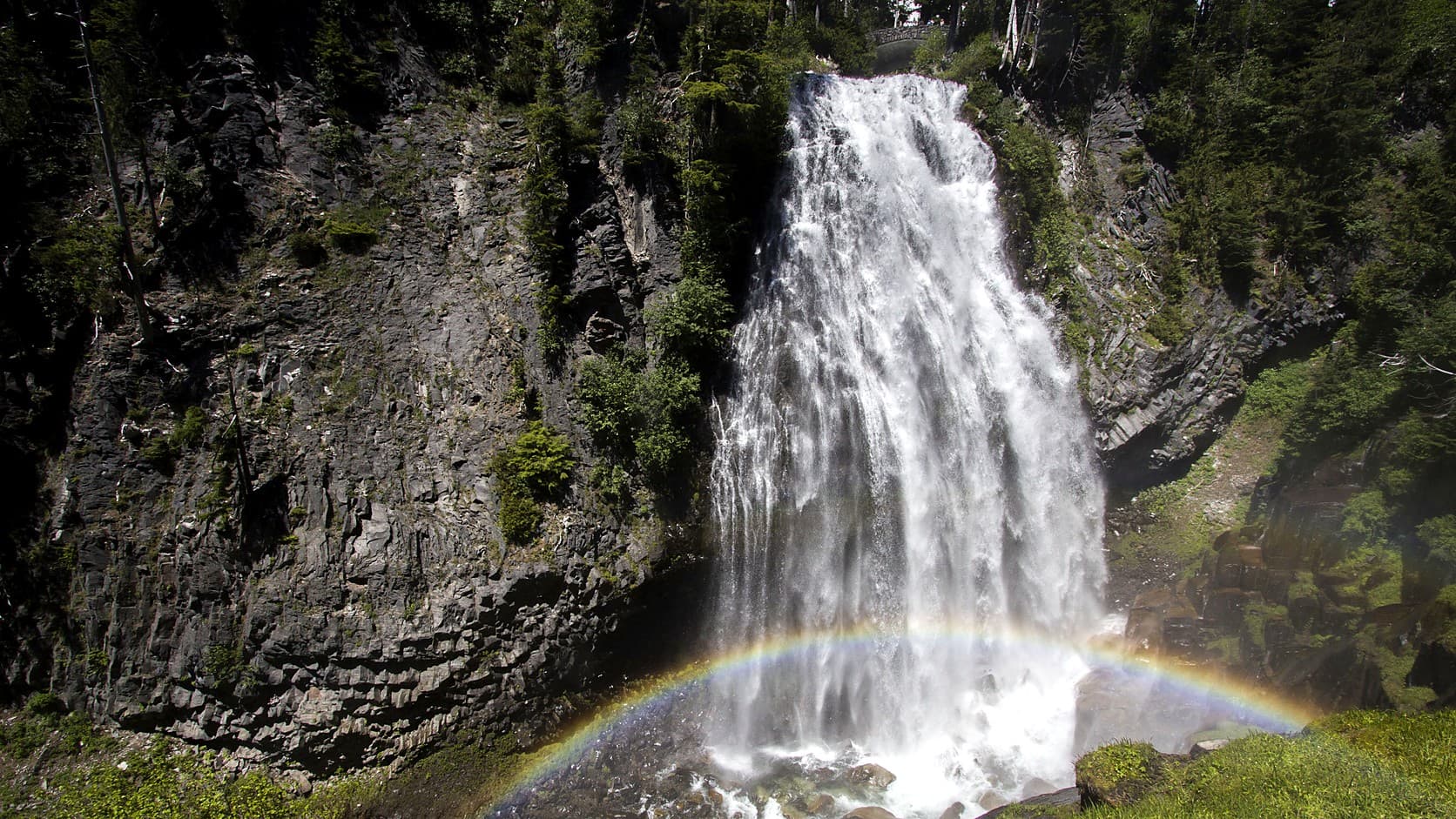
Narada Falls is a mile short of Paradise and about 17 miles from the Nisqually Entrance, roughly 77 miles and two and a quarter hours from Enumclaw on the year-round route; in summer, with Highway 410, Cayuse Pass and Stevens Canyon Road open, the east-side drive reaches it first, in about 72 miles and two hours. The Park Service calls it "the largest waterfall accessible by car in the park," 150 feet from the road. The upper pullout looks down on its top all year, and a steep 0.2-mile trail drops 200 feet to a viewpoint where all 168 feet show. The Paradise River runs clear rather than milky, the park explains, because it starts in snowfields rather than glaciers.
The road from Longmire to Paradise was open on the park's report of October 9, 2026, and Stevens Canyon Road is scheduled to close for the winter on October 26, 2026, a date the park posts on its road status page and says may change. After that, Paradise is reached only through Nisqually, and how much snow falls at Paradise each winter explains why the road above Longmire opens day by day.
7. Chenuis, Ranger and Spray falls, cut off since 2025
The State Route 165 Fairfax Bridge, a single-lane span three miles south of Carbonado, carried the only public road to the park's Carbon River and Mowich Lake corners. The state Department of Transportation closed it on April 14, 2025, after inspections found new deterioration in its steel supports, and eight days later made the closure permanent for cars, bicycles and people on foot. The Park Service's Carbon River and Mowich page says no other trail or route is open to the public from outside the park; the back roads that mapping services show cross private land behind locked gates.
Chenuis Falls was a 7.4-mile round trip from the Carbon River Entrance, over a footlog across the river; Ranger Falls, a side trip on the 10.8-mile round trip to Green Lake; Spray Falls, a spur two miles from Mowich Lake. As of October 2026 the park calls the area open to backpackers on the Wonderland Trail, the footpath around the mountain, about 19 miles from Sunrise to Ipsut Creek Campground or 27 from the Westside Road to Mowich Lake, with a wilderness permit for every night out. Since August 2026 fire closures have cut the first of those routes, closing the Wonderland Trail from the Carbon River Suspension Bridge to at least Frozen Lake near Sunrise; the park's alerts page carries the closure on to White River Campground.
The department's planning study, finished in December 2025, left two options, a new bridge just north of the old one or a highway left closed, and its January 2026 update put money only toward design and environmental review, not toward building either. How to reach Mowich Lake with the Fairfax Bridge closed has the details, and how the river took the Carbon River Road tells the valley's earlier loss.
Which waterfalls near Enumclaw can you see in winter?
Victor, Snoqualmie, Christine and Narada falls can all be seen in winter. The first two sit in parks open by day all year. The stretch of Highway 410 past Skookum and Snoquera lies outside the state's winter closure, which begins higher up, at Crystal Mountain Boulevard, but the Forest Service names spring as their season, and the Enumclaw to Crystal Mountain drive guide covers chains on that road.
At Mount Rainier, the road from Longmire to Paradise closes every night from November 1 through the winter and reopens each morning only if snow removal and conditions allow. On a typical winter day the gate opens at 9 a.m. and the uphill gate closes at 4 p.m., and every vehicle in the park must carry tire chains from November 1 to May 1, four-wheel drive included. The trails to the lower viewpoints at Christine and Narada are snow covered and hazardous in winter, the Park Service says.
Before you leave Enumclaw
Check the agencies on the morning you go. For the Highway 410 falls, the Mount Baker-Snoqualmie National Forest posts closures on its alerts page, and its Enumclaw office at 450 Roosevelt Avenue East, (360) 825-6585, is open Wednesdays and Fridays from 9 a.m. to 3 p.m. as of October 2026, closed from noon to 1. For Christine and Narada, the park's alerts carry the Longmire gate's outlook in winter after 4 p.m. the day before and an update after 7 a.m. the day of. Plan to pay the $5 day fee or carry a Northwest Forest Pass at the Highway 410 trailheads, and bring a card for the national park; Victor and Snoqualmie need no pass, though some Snoqualmie lots charge to park.
Story label: Original Story or Guide
Originally published: