

Feature
Beacon Rock trail closed Tuesday to Thursday to May 31, 2027
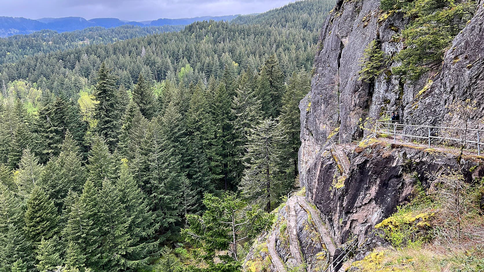
Beacon Rock trail is closed Tuesdays to Thursdays through May 2027 for new decking, State Parks says. Dates, what else is open, the pass and the drive.
As of October 2026, Washington State Parks says the Beacon Rock trail is closed every Tuesday, Wednesday and Thursday from October 1 through the end of May, so crews can replace its decking. The state's alert for the park runs to May 31, 2027. The park itself, on State Route 14 in Skamania County about 190 road miles from Enumclaw, stays open from 8 a.m. to dusk, and the alert names no closure on Fridays through Mondays. It does say "unless otherwise noted", so call the park office at (509) 427-8265 before you drive.
The path being re-decked is older than the state park. A Vancouver geologist named Henry Biddle bought Beacon Rock in 1915 "simply and wholly that I might build a trail to its summit", according to State Parks' park history, after a contractor had planned to blast the rock apart for jetty stone. He paid $10,000 of his own money, and the trail went in without the route being surveyed in advance.
Which days is the Beacon Rock trail closed?
The closure days are Tuesday, Wednesday and Thursday, from October 1 through the end of May, in what the alert calls intermittent closures. That is the wording of the Beacon Rock State Park page, where an alert posted September 14, 2026 reads: "The Beacon Rock trail will experience multi-day closures each week on Tuesdays, Wednesdays, and Thursdays from October 1 through the end of May, unless otherwise noted, for the replacement of trail decking." The alert ends on May 31, 2027. The Washington Trails Association's page for the hike, a nonprofit hiking group's listing, says the same thing in shorter form, through spring 2027.
Two limits on that. The alert and the Winter Schedule page both call these intermittent closures, and neither says whether all three days are shut in every week, so confirm your date before you drive. And "unless otherwise noted" means the park can change the schedule. The State Parks Winter Schedule page repeats the closure but prints a different area code, (360), for the park office. The park page, its alert and its contact block all give (509) 427-8265, so that is the number used here.
Why is the Beacon Rock trail closed?
State Parks gives one reason: the replacement of trail decking. The alerts do not say who is doing the work, how much decking is involved or whether the closure schedule will shorten if the work finishes early. Those details were not found, so treat the end date as the latest the park has posted rather than a promise of when the trail will reopen.
The decking sits on a trail that spends most of its length on the face of the rock. The park describes it as built "directly on the side of the rock with 52 switchbacks overlooking the Columbia River Gorge", and the Washington Trails Association describes handrails and a boardwalk on the south side of the rock that switchback to the top.
Can you hike anything else at Beacon Rock State Park while the trail is closed?
Yes, the park has far more trail than the one up the rock. State Parks counts 4,458 acres and "more than 26 miles of roads and trails" for hiking, mountain biking and horseback riding. The Washington Trails Association states that the other trails in the park remain open during the closure, and the park page lists no closure for any of them. The Winter Schedule page lists day use at the park as open and the campground as partly open.
The park page names several options by trailhead. The Hamilton Mountain Trailhead leads past Rodney Falls, Hardy Falls and Pool of the Winds toward the Hamilton Mountain summit. The Doetsch Walking Path is a paved, flat 1.2-mile loop with interpretive panels on natural and human history reaching back to the Ice Age floods, and State Parks calls it ADA accessible. The River to Rock Trail is described as leisurely and relatively flat, running between the Beacon Rock trailhead and the Doetsch path. This is a list of what the park page offers, not a promise about conditions on a given day. Check the alerts for each one.
The Doetsch path crosses what the park page calls a pasture of the Doetsch family ranch, which the park history says was bought in 1987. The same history says the purchase included the site of an Indigenous village that the Lewis and Clark journals describe, about a mile downstream of the rock.
How long is the Beacon Rock hike when it is open?
The Washington Trails Association lists the hike at 2.0 miles round trip with 600 feet of elevation gain, and gives 848 feet as the highest point. State Parks has its own measure of the rock, saying it "rises more than 840 feet above the Columbia River", and neither page says how its figure was measured, so the numbers should not be treated as interchangeable. The association says the grade is gentle for the climb, and the park says the trail has 52 switchbacks.
Parking, by the same association's page, is at the base of the rock, about 30 cars' worth, with restrooms at the eastern lot. It also notes that Riddell Lake, visible from the rock, is under half a mile round trip from the picnic area, which makes a short walk when the rock trail is shut. Lewis and Clark's party passed the rock on November 2, 1805, and Clark's journal, quoted by State Parks, called it "a remarkable high rock on Stard. Side about 800 feet high & 400 yds round".
Do you need a Discover Pass for Beacon Rock?
Yes, the park page lists the Discover Pass for day use: $45 for an annual pass, $10 for a one-day pass, as of October 2026. State Parks' Discover Pass page says one pass can be used on two vehicles but is valid for only one vehicle at a time, that transaction fees may apply, and that campers staying overnight do not need a pass to park in the park where they are staying. The Washington Trails Association says a pass machine stands at the eastern parking lot.
Prices change, and State Parks is the place that sets them, so read its pass page before you buy. The same page sends readers to the Discover Pass website for the list of free days, which cover day-use parking only. If you live near Enumclaw and wonder which of your passes fits which trailhead, the pass-by-pass guide for the plateau explains why no single one covers every agency, and the Rattlesnake Ledge winter guide shows the same Discover Pass question at a trailhead closer to home.
Who built the Beacon Rock trail, and why?
Biddle did, with a man named Charles Johnson, between October 1915 and April 1918, by State Parks' count. The trail is 4,500 feet long and 4 feet wide with a maximum grade of 15 percent, and the park history gives it 22 bridges and more than 100 concrete slabs spanning gaps in the cliffs. It also says the route could not be surveyed ahead of time because the terrain was too inaccessible.
Before Biddle, the rock came close to becoming a quarry. In 1912 a company bought two thirds of an interest in the property to take stone from the rock for the jetties at the mouth of the Columbia River, and proposed to dynamite it and barge the rubble out. The plan was shelved after a railroad company won a court case to condemn part of the property for a riverside line. Biddle died in 1928. In April 1935 the State Park Committee accepted 265 acres from his children, including the rock, and Civilian Conservation Corps crews later improved the trail he had built, according to the same history.
What is Beacon Rock, and why does an Enumclaw reader care?
State Parks' account makes Beacon Rock the core of an extinct cinder cone, a volcano built of loose cinders, that erupted about 57,000 years back. It belongs to the Boring Volcanic Field, which the park history says is distinct from the volcanoes and uplift that form the Cascade Range. Floods from the Ice Age, in the park's telling, stripped away everything except the hard core. The park says the field was named for the town of Boring, Oregon.
For anyone raised under Mount Rainier's mudflows, that is a useful difference: Beacon Rock is not part of the line of big Cascade volcanoes that the guide to Washington's volcanoes walks through. It sits in Skamania County, the same county as Mount St. Helens, which the winter guide to Mount St. Helens covers, and the county whose Sasquatch law the Bigfoot ordinance story reads section by section.
How far is Beacon Rock from Enumclaw?
By a routing service, OSRM, which uses OpenStreetMap data and does not count live traffic, the drive is about 188 miles and close to four hours, mostly on Interstate 5 and then State Route 14. The park's address is 34841 State Route 14, Skamania, WA 98648. Add time for traffic around Tacoma, Olympia and Vancouver, Washington, which a routing service cannot promise, and the closure days matter more when the round trip is most of a day.
Before you go
Check two things on the day. First, read the alerts on the Beacon Rock State Park page, including the intermittent closure notice and any climbing notice, then call (509) 427-8265 if the Tuesday to Thursday rule leaves you unsure about your date. Second, carry your Discover Pass or buy a day pass at the park. Dogs are allowed on a leash, according to the park page. Technical climbing is a separate matter with its own seasonal closures; the park says the south and southeast faces close each year on February 1 and tentatively reopen in mid-July.
Because the closure notice runs through May 31, 2027 and says "unless otherwise noted", the safest plan for any date between October 2026 and that date is to treat the park's own alert page as the schedule and this article as a summary of it.
Story label: Original Story or Guide
Originally published: